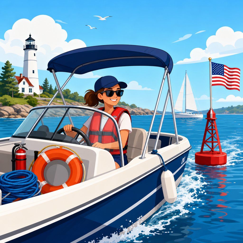

Restricted boating areas are portions of navigable water where operators must change speed, alter course, keep out entirely, or follow special rules designed to protect people, property, wildlife, and the waterway itself. Learning how to identify restricted boating areas on the water is one of the most important skills in safe, lawful boat operation because speed limits, no-wake zones, swim areas, security perimeters, and environmentally sensitive closures are not always marked the same way from one state or waterbody to another. I have found that many citations and near misses happen not because operators intend to break rules, but because they misread a buoy, assume local customs override posted controls, or wait too long to reduce speed. A restricted area can begin near a marina entrance, around a dam, beside a dredging project, near a bridge, inside a manatee zone, or around a military facility. The common thread is that the operator is expected to recognize the restriction early and respond immediately. This article explains what these areas are, how they are marked, what speed limits and no-wake requirements actually mean, and how to build a practical scanning routine so you can identify restricted boating areas before they create legal or safety problems.
What Counts as a Restricted Boating Area
A restricted boating area is any section of water where operation is limited by law, posted control, charted hazard, or temporary management measure. In practice, that includes idle-speed and no-wake zones, fixed speed-limit areas, exclusion zones around dams and spillways, construction areas, swimming beaches, ferry lanes, lock approaches, wildlife refuges, seaplane operating areas, and security zones around ships, ports, and government infrastructure. Some restrictions prohibit entry altogether; others allow transit only at a specified speed or only within a marked channel.
The best starting point is to separate three ideas that boaters often blur together: speed limits, no-wake operation, and restricted areas. A speed limit sets a maximum numerical speed, often in miles per hour or knots. A no-wake or idle-speed rule focuses on the effect of your vessel, not just the speedometer reading, because hull type, displacement, loading, and water depth all change wake size. A restricted area is the broader category that can include either of those rules plus access limits, direction-of-travel requirements, seasonal closures, and stand-off distances.
On many inland lakes, the first restricted areas a boater encounters are near ramps, marinas, fishing piers, and marked swim beaches. On rivers, restrictions commonly appear near bridges, narrow bends, dredge operations, and lock approaches. On coastal waters, expect manatee zones, harbor security zones, channels with local speed controls, and exclusion areas around naval vessels or terminals. Reservoirs often add safety buffers near dam structures and intake towers. The location changes, but the purpose stays consistent: reduce collision risk, shoreline erosion, propeller injury, and environmental damage.
State boating agencies, park authorities, harbor masters, and federal agencies may all establish restrictions, so local variation is normal. That is why chart study before departure matters, but on-water identification matters more. Rules are enforceable where you are, not where you launched. If a marked zone and your assumptions conflict, the marker wins until you can verify otherwise.
How Restricted Areas Are Marked on the Water
Most restricted boating areas are identified through a combination of regulatory markers, shoreline signs, charts, and notices. The U.S. Aids to Navigation System uses white buoys or signs with orange symbols and black lettering for regulatory information. An orange open diamond warns of danger, such as rocks, shoals, dams, or construction. An orange diamond with a cross means boats are excluded from that area. An orange circle states a controlled operation, commonly a speed limit or no-wake requirement. An orange square provides information or directions, including access instructions or local rules. These marker meanings are foundational, and every operator should recognize them instantly.
In the field, context matters just as much as symbol recognition. A white buoy with an orange circle and the words “IDLE SPEED” marks a different operating requirement than a white buoy with an orange diamond and cross reading “KEEP OUT.” Shore signs may reinforce the same rule from both banks of a river or at the entrance to a cove. Some agencies use flashing beacons, barricade floats, cable markers, or temporary work-zone signs when hazards are active. Around dredges, for example, you may see shapes, lights, and signs that indicate where passage is permitted and where equipment or pipelines make entry unsafe.
Electronic navigation helps, but it does not replace visual confirmation. NOAA charts, state lake maps, chartplotter overlays, and apps such as Navionics or Aqua Map can show bridges, channels, marine protected areas, and some exclusion zones. However, temporary restrictions from marine events, construction, rescue activity, or emergency spill response may appear first as Local Notice to Mariners entries, marina bulletins, sheriff advisories, or on-water patrol direction. I have seen boaters rely on a chartplotter zoom level that hid a restricted label entirely. The safer habit is to cross-check chart data with what is physically posted ahead.
| Marker or Sign | What It Means | What the Operator Should Do |
|---|---|---|
| Orange circle on white marker | Controlled operation, often speed limit or no wake | Reduce to the posted speed or operate at idle/no wake immediately |
| Orange diamond on white marker | Danger such as dam, rocks, cables, or work zone | Proceed with extreme caution and obey any added instructions |
| Orange diamond with cross | Boats keep out; area closed to entry | Do not enter; alter course early and stay clear |
| Orange square | Information or direction | Read the message fully; it may define channel use or local limits |
| Shoreline speed sign | Local speed zone boundary | Adjust before crossing the line, not after passing the sign |
Understanding Speed Limits and No-Wake Zones
Speed limits on the water are not as uniform as road limits, and that is where operators get into trouble. A posted “5 MPH” zone is straightforward, but many waterways instead require “idle speed,” “slow speed,” or “minimum wake.” Those phrases are related but not interchangeable under every local code. Idle speed usually means operating at the slowest speed that keeps steerage, generally just above neutral engagement. No-wake means the vessel must not produce a wake that could endanger others or damage shoreline, docks, or moored boats. Minimum wake may allow slightly more speed for control in current or wind, but the wake still must remain negligible.
The key legal point is that enforcement often depends on your vessel’s effect, not your intent. A heavy wake boat, stepped-hull fishing boat, or large cruiser may throw a substantial wake at a speed that feels modest from the helm. In shallow channels, the pressure wave and stern squat can increase shoreline impact even when your GPS speed looks low. That is why experienced officers watch the water behind the boat, the bow rise, and the reaction of nearby moored vessels. If your passage rocks tied boats, slaps docks, or pushes water onto a swim platform, you are probably too fast for the zone.
Real-world examples make the distinction clear. Entering a marina fairway, I bring the boat down before the marker line so the hull has settled by the time I cross into the zone. On a narrow river lined with private docks, I ignore the temptation to stay on plane until the last second because the cleanup wake travels farther than many operators realize. In manatee protection zones in Florida, signage may specify slow speed, minimum wake, or idle speed by season and area, and the difference matters. In a harbor approach, a 6-knot limit may be paired with a no-wash rule, meaning your speed must be low enough that your wake does not disturb berthed vessels.
Common Restricted Areas Every Boater Should Recognize
Some restricted areas are so common that you should anticipate them before you see the signs. Marina entrances and fuel docks nearly always require idle speed because maneuvering traffic, pedestrians, and fire risk demand close control. Public swim beaches and designated swim areas are often roped off or marked by buoys, and power-driven boats must stay outside. Dams, spillways, weirs, and flood-control structures usually have exclusion zones because current can overpower a boat long before danger is obvious from the surface. Lock approaches require reduced speed and strict directional awareness due to commercial traffic and confined water.
Bridges and construction zones deserve special attention. Temporary restrictions may narrow the safe passage span, move traffic to one side, or bar transit during active work. Dredging projects can create floating pipeline hazards that are difficult to judge from a distance. Ferry routes also create practical restricted areas; even where not fully closed, crossing ahead of a ferry in a narrow approach can violate local navigation rules and create a dangerous situation. Around airports or seaplane bases, marked water lanes may limit where boats can loiter or cross.
Environmental and wildlife zones are another major category. Manatee areas, bird nesting sanctuaries, spawning closures, shellfish protection waters, and vegetation restoration sites may carry seasonal or year-round limits. These areas are not decorative conservation messaging; they are enforceable operating controls that can bring significant fines. On western reservoirs, habitat coves may be closed during nesting season. In coastal marshes, shallow-grass restoration zones may ban propeller access to prevent scarring. The practical lesson is simple: if the area looks ecologically sensitive, expect the possibility of a restriction and slow down early enough to read every sign.
How to Read the Water and Spot Restrictions Early
The most effective way to identify restricted boating areas is to use a disciplined scanning routine rather than waiting for a buoy to appear directly ahead. I teach operators to scan in layers. Start far ahead for shoreline signs, unusual buoy patterns, bridges, marinas, dams, mooring fields, beach crowds, and work barges. Then scan midrange for regulatory markers, crossing traffic, and patrol boats. Finally, check near water for paddlecraft, swimmers, fishing lines, submerged cables, and the wake your own boat is producing. This layered scan works because restrictions usually reveal themselves through context before the text on the sign becomes readable.
Sound and behavior on the water provide clues too. If other boats are already off plane, there is usually a reason. If you hear construction machinery, see a dredge tender, or spot a line of moored sailboats in a narrow channel, assume speed control is imminent. On rivers, watch for current seams and warning booms upstream of dams; by the time the water looks dangerous, your escape options may be limited. At night, reduced visibility makes early identification harder, so preplanned routes, conservative speed, radar where fitted, and close attention to lighted aids become essential.
Good boat handling supports compliance. Reducing speed gradually before the zone avoids throwing a final large wake. Keeping a proper lookout allows you to read signs without abrupt turns. If you are unsure whether a marker applies to your direction of travel, assume it does until proven otherwise. When patrol or harbor staff give instructions, follow them first and sort out questions later. The operators who avoid trouble are usually the ones who treat every ambiguous marker as important, not the ones who try to argue that they did not see enough detail at speed.
Pre-Departure Planning and Legal Awareness
The easiest restricted area to identify is the one you already expect. Before leaving the dock, review the chart, state boating handbook, park rules, and current local notices for your route. Many state agencies publish lake-specific maps showing no-wake coves, ski zones, and dam exclusion lines. For coastal trips, NOAA charts, Coast Guard Local Notice to Mariners, and harbor authority bulletins can reveal security zones, special anchorages, regulated navigation areas, and temporary closures. Rental operators should brief every customer on local markers because visiting boaters are the group most likely to miss nonstandard signage.
Enforcement authority may come from state conservation officers, marine police, sheriff deputies, harbor patrol, park rangers, the Coast Guard, or facility security. Penalties range from warnings to fines, removal from the area, liability for damage, or charges tied to reckless operation. Insurance consequences can follow if a wake-related incident causes injury or property damage. Documentation matters as well. If you transit unfamiliar water frequently, save route notes, screenshot local rule maps, and update your charting app. I keep a simple departure checklist that includes local speed zones and seasonal restrictions because memory is unreliable when weather, passengers, and traffic add workload.
Restricted boating areas are easiest to handle when you combine planning, marker recognition, and conservative judgment. Know the standard regulatory symbols, understand the difference between a numerical speed limit and a no-wake requirement, and expect restrictions near marinas, beaches, dams, bridges, wildlife habitat, and active work sites. Slow down before you reach the boundary, not after you cross it, and remember that your wake is part of your responsibility even when no number is posted. When charts, signs, and local practice seem inconsistent, defer to the most restrictive visible control and verify later. That habit protects passengers, shoreline property, and the waterways everyone shares. If you want fewer surprises on the water, make restricted-area identification part of every pre-departure plan and every active helm scan.
Frequently Asked Questions
How can I recognize a restricted boating area while I am already on the water?
The most reliable way to identify a restricted boating area is to look for a combination of official markers, shoreline signs, charted information, and on-water conditions rather than relying on a single clue. Restricted areas are often marked with regulatory buoys, such as white markers with orange symbols or lettering, posted speed limits, no-wake notices, keep-out warnings, swim area boundaries, or exclusion zones around dams, bridges, marinas, and government facilities. In many places, local authorities also post signs on docks, pilings, breakwalls, and shore structures that explain whether you must slow down, stay outside a marked boundary, or avoid the area entirely.
It is also important to understand that restricted boating areas are not always marked in exactly the same way from one state, lake, river, or coastal area to another. Some zones are identified by buoy lines, others by dayboards, and some by temporary notices related to hazards, wildlife protection, construction, or special events. That is why prudent operators scan well ahead, reduce speed when approaching uncertain markers, and compare what they see with their chartplotter, paper chart, or local boating guide. If an area appears controlled, crowded, environmentally sensitive, or clearly posted with rules, treat it as restricted until you confirm otherwise. Slowing early and giving marked areas a wide berth is usually the safest and most lawful decision.
What do no-wake zones and slow-speed areas actually require me to do?
No-wake and slow-speed zones require more than simply backing off the throttle a little. In a no-wake zone, you are generally expected to operate at idle speed or the minimum speed needed to maintain steering, while producing little or no wake behind the vessel. The purpose is to protect other boaters, swimmers, shoreline property, docks, moored boats, and sensitive habitat from the damaging effects of wave action. In many waterways, law enforcement officers judge compliance by the size of your wake as much as by your actual speed, so a boat that is still throwing a noticeable rolling wake may be considered in violation even if the operator believes they are going slowly.
Slow-speed zones can vary by jurisdiction, but they usually require operation at a controlled speed that minimizes wake and allows the operator to react quickly to congestion, hazards, or nearby people in the water. These areas are common near marinas, launch ramps, channels with heavy traffic, residential shorelines, and narrow waterways. The best approach is to reduce speed before entering the zone, come fully on plane well before the zone begins if appropriate, and then settle into a speed that keeps the bow under control and the wake minimal. Waiting until you cross the marker to slow down often creates one last large wake right where restrictions matter most, which defeats the purpose and may still expose you to enforcement action.
Are restricted boating areas always marked with buoys, or do I need to check charts and local rules too?
Restricted boating areas are not always fully marked with buoys, and that is exactly why checking charts, notices, and local regulations is essential. While many common restrictions are marked on the water, some are seasonal, temporary, poorly visible in rough conditions, moved by weather, or dependent on local ordinances. For example, wildlife nesting closures, manatee or habitat protection zones, emergency work areas, regatta courses, dredging projects, security perimeters, and water intake or dam exclusion zones may be described in local rules, marine notices, or chart updates even if the physical markers are limited or temporarily absent.
Good seamanship means preparing before departure and staying alert during the trip. Review your route on updated navigation charts, check state boating agency guidance, read marina or launch-area postings, and pay attention to temporary safety broadcasts or posted notices at ramps and harbormaster offices. Electronic chartplotters can be very helpful, but they should not be your only source because not every device is equally current or detailed. If you combine pre-trip planning with visual observation on the water, you are far less likely to accidentally enter a restricted zone. When there is any conflict between what you expected and what is posted on site, follow the most conservative interpretation until you can verify the rule.
What kinds of boating areas are commonly restricted, and why are those restrictions in place?
Restricted boating areas exist for several different safety, security, and environmental reasons. Common examples include swim areas, where boats must stay out completely to protect people in the water; no-wake zones around marinas, docks, and residential shorelines to prevent damage and reduce collision risk; exclusion areas near dams, spillways, locks, bridges, and water control structures because currents and turbulence can become deadly; and security zones around naval facilities, ferries, tankers, or other sensitive infrastructure where unauthorized entry may be prohibited by law. Some waterways also restrict engine types, speed, direction of travel, towing activities, or hours of operation in specific zones.
Environmental protection is another major reason for boating restrictions. Sensitive wetlands, seagrass beds, fish spawning grounds, bird nesting areas, and protected wildlife habitats may be closed seasonally or permanently to reduce noise, propeller scarring, shoreline erosion, and disturbance. In other places, restrictions are designed to manage congestion and reduce accidents in narrow channels or heavily used recreational waters. Understanding the reason behind the restriction helps you comply more effectively. A no-entry area is not just a suggestion; it is usually there because someone has already identified a serious risk to human life, property, public security, or the ecosystem. Treating those boundaries with respect is part of responsible boat operation.
What should I do if I am unsure whether an area is restricted or if the markers are confusing?
If you are unsure whether an area is restricted, the safest response is to slow down immediately, keep a greater distance from the area, and avoid entering until you can verify the rule. Uncertainty on the water should never be answered with speed or assumption. Reduce to a controlled pace, maintain a sharp lookout for additional signs or buoy markings, and check your chartplotter, paper chart, or boating app for regulatory information. If passengers are aboard, ask someone to help scan for posted signs, shoreline notices, or buoy labels while you continue navigating cautiously.
If the markers seem damaged, inconsistent, or hard to interpret, do not guess. Contact the local marina, harbormaster, marine patrol, park office, or waterway authority if practical. In some situations, especially near dams, swim beaches, military facilities, or environmental closures, the consequences of entering the wrong area can be serious even if the marking was not obvious. It is far better to idle outside the area, reroute, or wait for clarification than to risk a citation, collision, grounding, or injury. Experienced operators understand that caution is not hesitation; it is judgment. When in doubt, stay out until you know exactly what the restriction requires.