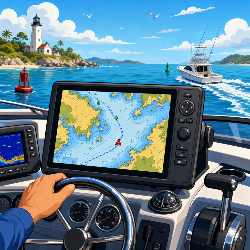
The best marine GPS systems do far more than display a boat icon on a chart. They combine satellite positioning, digital cartography, sonar networking, radar overlays, AIS target tracking, route planning, and reliable hardware designed for wet, bright, and vibrating environments. For anyone building out boating gear and equipment, electronics and navigation systems sit at the center of safe, efficient time on the water. A strong setup helps you avoid shoals, find channels, return to waypoints in fog, monitor traffic, and make better decisions when weather or visibility changes quickly.
Marine GPS refers to a dedicated onboard navigation device or multifunction display that uses global navigation satellite systems, typically GPS along with GLONASS, Galileo, or BeiDou, to calculate position, speed, course, and time. In practice, most buyers are choosing between a standalone chartplotter and an MFD that integrates charting with radar, sonar, engine data, autopilot, and communications. The difference matters. A weekend angler on a skiff may only need accurate chart plotting and waypoint marking. An offshore skipper, cruiser, or guide usually needs a networked system with NMEA 2000, high brightness, touchscreen and keypad control, and support for premium charts from Navionics, C-MAP, or Garmin Navionics+.
I have installed and tested marine GPS units on center consoles, bay boats, and coastal cruising boats, and one lesson is consistent: the right system is less about the most expensive screen and more about fit. Screen visibility in noon sun, chart redraw speed, simple route editing, and dependable external antennas often matter more than a flashy feature list. Saltwater also punishes weak hardware. Sealed connectors, solid mounting, responsive support, and a mature software platform are what separate a confidence-building navigation system from one that becomes a frustration every trip.
This hub article covers the full electronics and navigation systems category so you can choose intelligently and know what to research next. It explains the core features that define the best marine GPS systems, compares leading brands, shows how networking works, and outlines installation and maintenance priorities. If you are upgrading boating electronics, this page gives you the framework to navigate like a pro rather than buying blind.
What makes a marine GPS system truly professional
A professional-grade marine GPS system is accurate, readable, fast, and integrated. Accuracy starts with the receiver. Modern units routinely deliver position accuracy within a few meters, and many improve consistency by using multiple satellite constellations and optional augmentation such as WAAS in North America. Accuracy alone is not enough, though. The system must place that position on high-quality charts with smooth panning and zooming, then let you create routes, save tracks, and mark hazards without delay.
Readability is the next dividing line. On the water, you are looking at the display through polarized sunglasses, at odd angles, with spray on the screen and sunlight reflecting off white fiberglass. Good units use high-nit displays, anti-glare coatings, and user interfaces designed for motion. In rough water, I still prefer hybrid control systems that combine touchscreen with physical keys or a rotary knob. Touch-only screens feel modern at the dock; offshore, buttons can be faster and safer.
Integration turns a chartplotter into a navigation system. A serious setup connects GPS with depth data, side imaging or traditional sonar, radar, AIS, VHF radio, heading sensors, and autopilot. Overlaying radar on the chart, for example, helps confirm a buoy line or shoreline in rain. AIS adds identity, course, and speed for commercial traffic and nearby equipped vessels. A heading sensor stabilizes the chart orientation at low speed, which matters when maneuvering into a harbor entrance or following a narrow creek.
Reliability rounds out the list. Look for an IPX-rated display, proven software, and easy backup options. The best operators still carry redundancy: a secondary plotter, handheld GPS, paper chart for the cruising area, or a tablet with downloaded charts in a waterproof case. Electronics are powerful tools, not excuses to abandon seamanship.
Core features to compare before you buy
When people ask what features matter most in the best marine GPS systems, I suggest starting with six: screen size, mapping, networking, sonar compatibility, radar support, and interface. Screen size sounds obvious, yet it drives almost every decision. On a small console, a 7-inch display may fit perfectly, but split-screen radar and charting can feel cramped. At 9 to 12 inches, route planning and sonar interpretation become much easier. For cruising boats, twin 12-inch displays are a common sweet spot because they preserve dedicated space for chart and radar without constant menu switching.
Mapping is equally important. Garmin users often like the polished integration of Garmin Navionics+ or BlueChart style data, while Simrad and Lowrance buyers may lean toward C-MAP and Navionics depending on region and fishing style. Coastal users should inspect tide stations, marsh creek detail, buoy data, and relief shading availability. Great Lakes and inland anglers may prioritize contour definition and custom depth shading. Chart subscription costs and update frequency deserve attention because stale charts are a real operational risk.
Networking determines expandability. NMEA 2000 is the standard backbone for engine data, heading sensors, fuel flow, wind instruments, and many autopilot components. Ethernet links higher-bandwidth devices such as radar, sonar modules, and display-to-display chart sharing. Before buying, sketch the full system you may want in two years, not just what you can afford now.
| Feature | Why It Matters | Best Fit Example |
|---|---|---|
| 9 to 12 inch display | Readable split screens for chart, sonar, and radar | Coastal center console or family cruiser |
| NMEA 2000 networking | Shares engine, fuel, heading, and autopilot data | Owners planning future upgrades |
| Radar overlay support | Improves situational awareness in fog and rain | Offshore and shoulder-season boaters |
| AIS integration | Shows vessel identity, CPA, and traffic movement | Busy inlets, shipping lanes, and cruisers |
| Hybrid controls | Easier use in chop with wet hands | Anglers and offshore operators |
Sonar and radar support matter even if your current use is basic navigation. Many buyers start with GPS and charts, then add a transducer, black-box sonar module, or dome radar later. Buying within a compatible ecosystem saves money and labor. Interface is the final filter. Garmin tends to feel approachable, Simrad often appeals to power users, Lowrance is strong with anglers, Humminbird dominates many freshwater conversations, and Raymarine remains respected for cruising and radar integration. None are perfect; the best one is the one you can operate instantly under pressure.
Best marine GPS brands and who they suit
Garmin is the easiest recommendation for many boaters because it balances polish, broad product depth, and user-friendly menus. The ECHOMAP and GPSMAP lines cover everything from compact fishing boats to offshore platforms. Garmin’s chart handling is clean, autopilot integration is mature, and its radar and sonar ecosystem is extensive. If you want a dependable all-around chartplotter that does many things well with minimal learning curve, Garmin is often the benchmark.
Simrad targets serious anglers and performance-minded operators who want deep control and sharp displays. The NSS and NSX families, depending on model generation, are common on center consoles and offshore fishing boats. Simrad pairs well with Halo radar and advanced sonar setups, and many captains appreciate the interface once learned. The tradeoff is that newcomers may need more time to configure pages, data overlays, and network settings.
Lowrance is a practical choice for inland and coastal anglers, especially where sonar performance and fishing features carry more weight than offshore cruising functions. HDS and Elite series displays deliver strong chartplotter capability, and Lowrance has a long reputation with StructureScan and fish-finding tools. For bass boats, bay boats, and mixed-use family fishing rigs, it often delivers excellent value.
Raymarine remains a strong option for cruisers, sailors, and mixed-use powerboats. Axiom displays are capable and bright, Quantum radar is widely recognized, and Raymarine has done a good job integrating sailing data, thermal imaging, and autopilot in larger systems. Humminbird deserves mention for anglers, especially those invested in LakeMaster mapping and advanced freshwater sonar technologies, though it is less commonly the first recommendation for broad saltwater navigation hubs.
Furuno also belongs in any serious discussion. It has long held a reputation for commercial-grade reliability and excellent fish-finding, particularly among offshore captains. The user experience can feel less consumer-gadget-like than Garmin, but that is not a criticism. Many professionals value Furuno precisely because it is built around dependable marine function. Brand choice should follow use case, local dealer support, and your willingness to learn one ecosystem thoroughly.
How GPS fits with radar, AIS, sonar, and autopilot
Marine navigation becomes dramatically more capable when GPS is only one part of a connected system. Radar is the most important companion for reduced visibility. In fog, darkness, or rain, a chartplotter shows where you should be, while radar shows what is physically around you right now. Overlaying radar returns on the chart helps verify landmasses, jetties, and moving vessels. Modern solid-state radar, such as Garmin Fantom, Simrad Halo, or Raymarine Quantum, starts quickly and draws less power than older magnetron units.
AIS complements radar by identifying equipped vessels and calculating closest point of approach. In busy harbors and near shipping lanes, AIS data on the chartplotter gives you names, headings, and speeds for targets that might otherwise be ambiguous blips. A VHF radio with integrated AIS receiver or transponder can feed this information to your display. For cruisers and offshore anglers, AIS is one of the highest-value upgrades after radar.
Sonar integration matters for both fishing and safety. Depth soundings confirm charted depths, reveal uncharted shoaling, and support confident movement through tidal areas. Side imaging and forward-looking sonar do not replace charts, but they add context. I have used sonar repeatedly to validate a creek entrance after winter shifting altered the channel edge. It is an aid, not a substitute, yet a powerful one.
Autopilot closes the loop. Once your GPS, heading sensor, and pilot are networked, you can follow routes more precisely and reduce helm fatigue on long runs. This does not make the boat autonomous. You are still responsible for lookout, collision avoidance under the COLREGs, and route sanity. But on a long transit or troll, integrated autopilot can make navigation smoother, safer, and far less tiring.
Installation, setup, and maintenance mistakes to avoid
The best marine GPS systems underperform when poorly installed. Mounting angle, power quality, antenna placement, and network design all matter. Start with dedicated power protection and proper wire sizing. Voltage drop causes mysterious reboots and sonar instability, especially during engine cranking or when pumps cycle. Use marine-grade tinned wire, sealed heat-shrink terminals, and clean fuse block organization. Sloppy electrical work is one of the most common causes of electronics complaints.
Transducer placement is another make-or-break issue. A premium sonar module cannot compensate for aerated water flow under the hull. Follow manufacturer guidance on setback, deadrise, and strake interference. For GPS reception, internal antennas are usually excellent on open boats, but hardtops and enclosed helms may benefit from external receivers or heading sensors placed clear of interference. NMEA 2000 backbones should be terminated correctly at both ends, with power inserted according to load planning rather than convenience.
Software setup deserves time at the dock. Update firmware, register charts, set chart datum defaults, configure shallow-water alarms, and create sensible home screens before the first trip. Then test every source: GPS fix, depth, heading, engine data, radar overlay, AIS targets, and waypoint sync. I also recommend naming waypoints consistently and backing up settings to a card when the platform allows it.
Maintenance is straightforward but often neglected. Clean screens with approved products, inspect connectors for corrosion, verify chart subscriptions before a cruise, and update software during the offseason rather than the night before departure. Most importantly, practice. The skipper who has used MOB functions, radar gain controls, and route editing in calm conditions will be vastly more effective when conditions deteriorate unexpectedly.
Choosing the right system for your boat and budget
The right answer depends on how and where you run. A kayak or small jon boat may only need a compact GPS-fishfinder combo with simple mapping and waypoint storage. A bay boat used for inshore fishing benefits from a 7- to 9-inch display, detailed coastal charts, and a transducer capable of clear bottom tracking in skinny water. An offshore center console usually justifies at least one 12-inch MFD, radar, AIS, and a robust sonar package. Cruising boats often prioritize dual displays, radar, autopilot, engine integration, and route planning tools over specialized fishing sonar.
Budget planning should include more than the display. Real system cost includes charts, transducers, radar, antennas or heading sensors, mounts, cabling, NMEA 2000 components, installation labor, and software updates. A modestly priced display can become a premium project once networking expands. That is not a reason to delay; it is a reason to plan in phases. Buy the platform you want to grow into, then add components as your boating evolves.
The best marine GPS systems help you navigate like a pro because they reduce uncertainty, improve awareness, and turn scattered information into a clear picture of where you are, what surrounds you, and where you should go next. Start with your real use case, choose a brand ecosystem with strong support in your area, and invest in proper installation. Then learn the system until using it is second nature. If you are building out your boating gear and equipment, use this electronics and navigation systems hub as your starting point, compare the categories that matter most, and choose a setup that will keep you confident every time you leave the dock.
Frequently Asked Questions
What features matter most when choosing the best marine GPS system?
The most important features depend on how and where you boat, but a few capabilities matter for almost everyone. First, look for highly accurate GPS positioning with fast satellite acquisition and dependable performance in changing conditions. A quality unit should pair that positioning data with detailed charts, clear screen readability in direct sunlight, and an interface that is easy to use while underway. If a system is difficult to navigate at the helm, even excellent hardware becomes less useful in real-world boating situations.
Beyond core positioning and charting, many of the best marine GPS systems now function as a central navigation hub. That means they can integrate with sonar, radar, AIS, autopilot, engine data, and VHF communication systems. This kind of networking allows you to overlay radar on charts, track nearby vessel traffic, mark fishing spots, monitor depth, and create safer routes through unfamiliar waters. If you boat offshore, in busy harbors, or in low-visibility conditions, this integration can significantly improve situational awareness.
Durability is another major factor. Marine electronics need to withstand spray, vibration, heat, and constant exposure to bright light. A rugged waterproof housing, responsive touchscreen or keypad controls, and a display that remains readable in rough weather are all important. In short, the best choice is not just the one with the longest feature list, but the one that combines accuracy, clear charts, reliable networking, and marine-grade build quality in a package that fits your style of boating.
Is a chartplotter the same thing as a marine GPS, or is there a difference?
A marine GPS and a chartplotter are closely related, but they are not exactly the same thing. A GPS receiver determines your position using satellites. A chartplotter takes that location data and displays it on digital nautical charts so you can see where you are relative to channels, markers, hazards, contours, and waypoints. In practical terms, most modern boaters shopping for a “marine GPS” are really looking for a chartplotter with built-in GPS functionality.
This distinction matters because some entry-level devices may provide location and route guidance but not offer the same depth of charting, screen quality, or system integration as a full-featured chartplotter. Higher-end units often include advanced route planning, sonar support, radar compatibility, AIS overlays, and network sharing between multiple displays. Those capabilities move the device beyond basic navigation into a more complete onboard electronics system.
For most recreational and serious boaters, a dedicated chartplotter with integrated GPS is the better solution because it is purpose-built for marine use. It offers a larger display, more detailed chart handling, and better visibility than relying on a general-purpose device alone. If your goal is to navigate like a pro, you want a system that not only knows your position, but also helps you interpret the surrounding water, track traffic, avoid hazards, and manage routes with confidence.
Do I still need a dedicated marine GPS if I can use a phone or tablet for navigation?
Phones and tablets can be helpful backup tools, but they are not a full replacement for a dedicated marine GPS system in most boating situations. Consumer mobile devices are not designed first and foremost for wet decks, salt exposure, prolonged sun glare, helm vibration, or all-day operation on the water. Even if the navigation app is excellent, battery life, overheating, water intrusion, and screen readability can become real problems at exactly the wrong time.
A dedicated marine GPS or chartplotter is built for reliability in harsh conditions. It usually offers a brighter display, waterproof construction, direct power from the boat, and better integration with the rest of your marine electronics. That integration is a major advantage. A dedicated system can connect to sonar, radar, AIS, autopilot, and onboard networks in ways that a mobile device generally cannot match. It also tends to provide a more stable and responsive experience when you are moving quickly, navigating narrow channels, or operating in reduced visibility.
The smartest approach for many boaters is to use both. Treat the fixed-mount marine GPS as your primary navigation system and keep a phone or tablet loaded with charts as a secondary or emergency backup. Redundancy is always a good idea on the water. But when safety, route management, and dependable real-time navigation matter most, a proper marine GPS system remains the gold standard.
How do sonar, radar, and AIS improve a marine GPS system?
These technologies turn a marine GPS from a simple position display into a much more complete decision-making tool. Sonar helps you understand what is below the boat, including depth changes, bottom contours, structure, and in many cases fish targets. For anglers, this is valuable for locating productive areas. For cruisers and general boaters, sonar adds another layer of safety by helping monitor depth trends near shoals, flats, and unfamiliar approaches.
Radar improves awareness above the water, especially when visibility is limited by darkness, rain, fog, or heavy traffic. When integrated with a chartplotter, radar targets can be overlaid directly on your chart, making it easier to compare what the radar sees with known land, channel edges, buoys, and other objects. This can be especially useful when entering an inlet, crossing open water in poor conditions, or navigating crowded coastal areas where visual references may be limited or confusing.
AIS, or Automatic Identification System, adds vessel traffic intelligence by showing other AIS-equipped boats on your screen along with information such as course, speed, and identity. This is extremely useful in commercial shipping lanes, busy marinas, and areas with frequent crossing traffic. Together, sonar, radar, and AIS give you a better picture of what is below, around, and ahead of your vessel. When these layers are combined with GPS location and digital charts, you gain the kind of situational awareness that helps experienced boaters navigate more safely and more efficiently.
What screen size, chart coverage, and installation setup should I choose for my boat?
Screen size should be based on your helm layout, viewing distance, and how much information you want visible at once. Smaller boats with limited dash space may do well with a compact display, but if you routinely split the screen between charts, sonar, engine data, and radar, a larger unit quickly becomes worthwhile. Bigger screens make route planning easier, improve readability in rough conditions, and reduce the need to constantly switch between pages. The best size is one that you can clearly read and operate from the helm without leaning in or losing focus on the water ahead.
Chart coverage is just as important as hardware. Make sure the system supports detailed charts for the waters you actually run, whether that means inland lakes, coastal bays, offshore routes, or tidal river systems. Some units come bundled with broad regional coverage, while others may require additional chart purchases or subscriptions for premium detail. Look for clear depth contours, navigation aids, marina information, and regular chart updates. If you travel between regions, it is wise to confirm expandability before buying.
As for installation, think about the marine GPS as part of a larger electronics ecosystem. A standalone unit may be fine for simple navigation, but many boaters benefit from networking capabilities that allow sharing data with transducers, radar domes, AIS modules, VHF radios, and additional displays. Also consider power supply, mounting angle, glare, cable routing, and ease of access for updates or service. A well-installed system is easier to use, more reliable over time, and better positioned to support future upgrades as your boating needs grow.