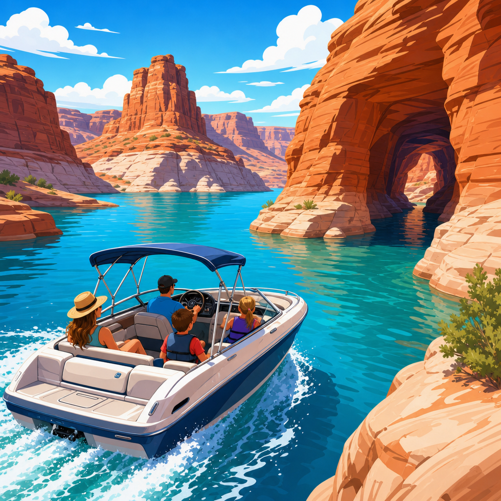
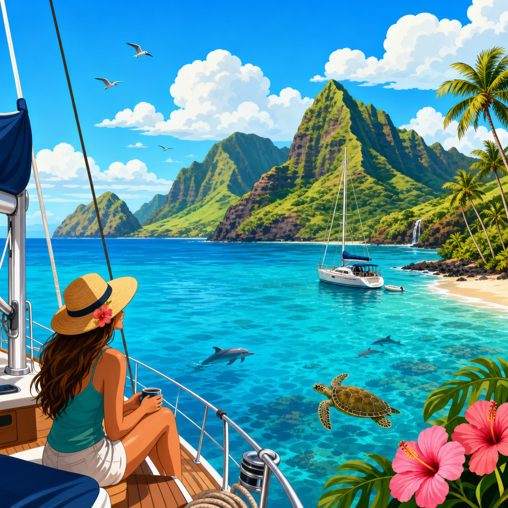
Exploring Hawaii by boat turns the island chain from a set of separate destinations into one connected cruising ground, where weather, anchorages, permits, and local knowledge matter as much as scenery. Coastal cruising means moving along a shoreline in manageable passages, stopping in bays, harbors, and roadsteads instead of attempting nonstop offshore runs. Island hopping adds longer crossings between islands, requiring careful route planning because Hawaii sits alone in the central Pacific, exposed to strong trade winds, ocean swell, and limited all-weather refuge. For sailors, powerboaters, and charter guests, that combination makes Hawaii uniquely rewarding and unusually demanding.
I have planned and reviewed Pacific itineraries where crews assumed Hawaii would behave like the Caribbean, only to discover that the state offers fewer protected anchorages, stricter conservation rules, and bigger weather consequences. The payoff is exceptional: volcanic coastlines, humpback whale habitat in season, clear-water snorkel sites, and harbors that put you close to historic towns, reefs, and hiking trails. Done properly, a Hawaii boating trip delivers access that road travel cannot match. You can enter Napali viewpoints by sea, watch sunrise under Haleakala after a harbor stay on Maui, or stage a Big Island passage around seasonal wind shadows.
The key terms are simple. Anchorage refers to a place where a vessel can safely lie to anchor, usually judged by bottom holding, protection from wind and swell, room to swing, and access ashore. A mooring is a fixed buoy or tackle provided by a marina, park, or private operator, often requiring reservation or permit. A harbor is a built port with slips, fuel, and services, while a roadstead is a more open anchoring area with partial shelter. In Hawaii, these distinctions matter because many seemingly beautiful bays are untenable once trade-wind swell wraps in or local afternoon gusts build.
This guide covers the best Hawaiian islands for boating, where to anchor or shelter, how to choose routes, and what limitations to respect. It serves as a hub for coastal cruising and island hopping by giving the big-picture framework first: which islands suit different boaters, how conditions change by coast, and why seamanship standards need to be higher here than in easier charter regions.
Understand Hawaii’s boating conditions before choosing islands
The first question most travelers ask is simple: can you boat between the Hawaiian islands safely? Yes, but not casually. The channels between islands accelerate the northeast trades and can stack steep seas against current and local wind effects. The Alenuihaha Channel between Maui and the Big Island is the classic example. It is notorious for strong winds, rough seas, and violent gusts rolling off high volcanic terrain. Even experienced crews treat it with respect, often choosing very early departures, favorable forecasts from NOAA, and conservative go or no-go criteria.
Protection in Hawaii is highly directional. South shores are generally calmer in summer, while north shores become dangerous in winter surf. West-facing coasts on leeward sides often offer the best cruising weather, especially around Maui County and Kona. The state’s dry leeward zones also support better visibility for reef spotting, snorkeling, and tender landings. Windward coasts can be spectacular but are often exposed, rainy, and uncomfortable for overnight anchoring.
Before building an itinerary, check NOAA marine forecasts, local harbor advisories from the Hawaii Department of Land and Natural Resources, and surf outlooks from the National Weather Service Honolulu office. I also recommend reviewing Navionics, paper charts, and satellite imagery together. In Hawaii, charted depth alone is not enough. Reef shelves, surge, lava rock, coral protection zones, and rapidly changing swell angles can all turn a marginal stop into an unsafe one.
Fuel and marina access are more limited than many visitors expect. Honolulu, Lahaina’s former traffic patterns, Maui harbors, and Kona-area facilities each have different service levels, and post-storm or post-fire changes can alter availability quickly. That means provisioning, water management, and mechanical reliability are central to route planning. If your vessel depends on daily marina stops, your options narrow fast.
Oahu: best for access, services, and day cruising
Oahu is the most practical starting island for many boaters because it combines airport access, repair services, provisioning, and established harbor infrastructure. Honolulu Harbor, Ala Wai Small Boat Harbor, Kewalo Basin, and Ko Olina create a service network that does not exist on most outer islands. For travelers who want shorter passages and support nearby, Oahu is the easiest place to begin.
Day cruising on Oahu is strongest along the south shore. Waikiki to Diamond Head offers iconic skyline views, relatively straightforward navigation in settled conditions, and easy whale watching in winter. Kewalo Basin supports fishing and charter activity, and Ko Olina on the leeward side provides a more resort-centered departure point with calmer water in typical trade conditions. Kaneohe Bay, on the windward side, is one of the state’s few truly expansive protected waters, but boaters must navigate patch reefs carefully and follow local rules for sandbars, marine life, and restricted areas.
For overnighting, Oahu is more harbor-based than anchorage-based. Transient slips or advance marina arrangements are often preferable to open anchoring because swell wrap can make many roadsteads uncomfortable. If you want to combine boating with shore exploration, Oahu works exceptionally well: Pearl Harbor history, Honolulu dining, North Shore surf culture, and hiking access all sit within manageable distance of harbor facilities.
The tradeoff is crowding. Oahu’s nearshore waters can be busy with tour boats, fishing vessels, paddlers, and swimmers, especially near Waikiki and popular reef zones. The island is ideal for first-time Hawaii boat visitors, but it does not deliver the same remote feel as Kauai’s north shore or parts of Molokai.
Maui, Lanai, and Molokai: the strongest island-hopping cluster
If your goal is classic Hawaiian coastal cruising and island hopping, Maui County offers the best concentration of reachable destinations. The triangle formed by Maui, Lanai, and Molokai creates shorter interisland legs than routes involving Kauai or the Big Island, and it includes many of the state’s most visited boating grounds. Conditions can still be serious, especially in the Pailolo Channel and around exposed points, but the cruising logic is strong.
Maui’s leeward side is the center of activity. Maalaea Harbor is a common operational base, while the west side gives access toward Kaanapali, Honolua, and the Auau Channel. The Auau Channel, between Maui, Lanai, and Molokai, is famous for humpback whales from roughly December through April. During that season, speed management, lookout discipline, and legal stand-off distances are essential. The channel can be gentle in the morning and choppy by afternoon, so timing matters.
Lanai rewards boaters with clear water and less development. Hulopoe Bay is visually stunning but should be treated as a fair-weather stop rather than a guaranteed overnight anchorage. The south coast of Lanai offers dramatic cliffs and pockets of lee, while the island’s limited services mean self-sufficiency is important. Molokai is quieter still. Its south shore can provide workable stops in settled conditions, and its low-key character appeals to cruisers looking for a less commercial experience.
Maui itself can serve both charter guests and private skippers. Snorkeling sites near Molokini are world known, but heavy tour traffic means early arrival and careful situational awareness. The island also gives practical shore access to provisioning and repairs, making it one of the best hubs for multiday itineraries that combine comfort with genuine passage planning.
Big Island and Kauai: rewarding, but more specialized
The Big Island is often underestimated because of its size. In practice, it is a weather and distance island. The Kona coast on the west side offers the most usable cruising water, with drier conditions, good visibility, and access to Kailua-Kona and Keauhou. Kealakekua Bay is one of Hawaii’s standout boat destinations thanks to clear water, historical significance linked to Captain Cook, and strong snorkeling. It is also regulated and heavily used, so operators need to respect landing restrictions, protected resources, and day-use pressure.
Further north and south along the Kona coast, you will find lava-lined roadsteads and fishing harbors rather than a long chain of comfortable overnight anchorages. Rounding South Point or attempting the Alenuihaha crossing to Maui requires serious weather judgment. The island’s scale creates local wind effects that catch out crews expecting a simple coastal run.
Kauai is visually unmatched for many boaters. The Napali Coast is one of the great boat-access landscapes in the United States, with sea cliffs, caves, and beaches unreachable by road. Summer usually provides the best window for calmer water on the north and west sides. Even then, many stops are day-use only in practical terms because swell and surge make overnight anchoring uncertain. Hanalei Bay on the north shore can be beautiful and seasonally useful, but winter surf can render it untenable. Nawiliwili provides harbor access on the southeast side and is the more dependable service point.
For private cruisers, Kauai is best approached with a stable forecast and modest ambitions. Spectacular sightseeing is easy; secure multiday anchoring is not. That distinction matters when choosing whether to base a trip there or visit as one leg within a broader itinerary.
Best Hawaii anchorages and shelter spots at a glance
No single list works year-round, because Hawaii anchorages are seasonal and condition dependent. Still, several locations repeatedly stand out for scenery, access, or relative shelter. Use this comparison as a planning reference, then validate every stop against current forecast, swell direction, and official restrictions before arrival.
| Location | Island | Best use | Main advantage | Primary caution |
|---|---|---|---|---|
| Kaneohe Bay | Oahu | Protected day cruising | Sheltered water and multiple exploration zones | Reefs, marked channels, local restrictions |
| Ko Olina | Oahu | Marina base | Services, resort access, leeward conditions | Reservation and slip availability |
| Maalaea Harbor | Maui | Operations hub | Central position for Maui County cruising | Windy afternoons and harbor surge at times |
| Hulopoe Bay | Lanai | Fair-weather stop | Clear water, scenic setting | Limited protection for overnight use |
| South Molokai coast | Molokai | Quiet cruising stop | Less traffic, natural scenery | Exposure changes quickly with weather |
| Kealakekua Bay | Big Island | Snorkeling and history | Excellent water clarity and landmark appeal | Regulations, crowding, limited overnight comfort |
| Keauhou Bay | Big Island | Harbor access | Useful staging point on Kona coast | Not a substitute for broad sheltered cruising |
| Hanalei Bay | Kauai | Seasonal anchorage | Large bay and dramatic setting | Unsafe in winter surf |
| Nawiliwili Harbor | Kauai | Service harbor | More dependable port infrastructure | Commercial traffic and exposure outside harbor |
The practical lesson is that Hawaii cruising often alternates between harbors and short fair-weather anchorage stays. Crews who expect sheltered cays every few miles will be disappointed. Crews who plan for mobility, early departures, and fallback harbors usually have a far better trip.
Permits, safety, and smart itinerary design
The best Hawaii boating itineraries are conservative by design. A strong seven-day plan might focus on one island plus nearby crossings, not an attempt to touch the entire state. For example, a Maui-based week can include west Maui day cruising, Lanai snorkeling stops, and a Molokai weather window without forcing long open-ocean commitments. An Oahu-based trip can combine south shore cruising, Kaneohe Bay, and one outer-island leg only if conditions align.
Safety starts with vessel suitability. Many Hawaii routes are appropriate only for seaworthy boats with reliable engines, updated ground tackle, AIS, VHF, EPIRB, and a crew comfortable with reef awareness and open-channel motion. This is not the place to test neglected systems. Carry extra fuel margin, rig chafe protection, and brief every guest on swell boarding, snorkel etiquette, and seasickness management. In my experience, crew fatigue rises faster here because even short passages can be active.
Permits and rules vary by harbor, bay, and activity. Mooring reservations, marine life conservation district rules, no-anchoring areas, and commercial-use restrictions can all apply. Coral damage, turtle harassment, and careless tender landings bring real consequences and should. Hawaii’s nearshore ecosystems are heavily used and ecologically sensitive. Use reef-safe practices, secure trash, avoid anchoring on coral, and confirm whether shoreline landing is allowed before sending a dinghy ashore.
Season matters. Summer generally favors leeward cruising and north shore access on islands like Kauai. Winter brings world-class surf, whale activity, and more exposure on north and west coasts depending on swell pattern. Shoulder seasons can be excellent, but only if you watch the forecast closely. The most successful boaters in Hawaii build flexible route trees, not rigid checklists. Start with the island that matches your skill level, reserve harbor options early, and treat every anchorage as condition dependent. That approach unlocks the state’s best boating: dramatic coastlines, meaningful passages, and access to places that still feel wild from the water.
Hawaii is one of the most memorable boating destinations in the world because it rewards preparation with experiences few cruising grounds can match. You can watch spinner dolphins off Lanai, drift over coral gardens near Molokini, enter the immense green amphitheater of Hanalei Bay, or idle beneath the lava cliffs of the Kona coast in a single trip. What makes those moments possible is not luck. It is route discipline, seasonal timing, and a realistic understanding of what each island offers.
The strongest takeaway is straightforward. Oahu is the easiest entry point for services and short cruises. Maui, Lanai, and Molokai form the best cluster for practical island hopping. The Big Island is excellent along Kona but demands respect for distance and weather. Kauai delivers unmatched scenery, yet many stops remain fair-weather only. Across the chain, harbors often matter as much as anchorages, and forecast interpretation matters more than bucket-list ambition.
Use this hub as your planning foundation for Hawaii coastal cruising and island hopping. From here, narrow your trip by vessel type, season, and cruising radius, then build supporting plans for harbors, provisioning, and protected stops. If you approach Hawaii by boat with patience and professional-level caution, the islands return the effort with access, perspective, and beauty that land travelers never fully see. Start with one island group, confirm your weather windows, and chart a route you can enjoy safely.
Frequently Asked Questions
What are the best Hawaiian islands to explore by boat?
The best Hawaiian islands to explore by boat depend on your experience level, vessel type, and what kind of cruising you want to do, but most boaters focus on the main inhabited islands: Oahu, Maui, Molokai, Lanai, Kauai, and Hawaii Island. For many cruisers, Oahu is the logical starting point because it offers the strongest boating infrastructure, including marinas, provisioning, repair services, fuel, and access to weather information. It is also a practical jumping-off point for shorter coastal runs and inter-island planning. Maui is popular for its dramatic coastline, whale watching in season, and access to nearby Lanai and Molokai, which makes it especially appealing for island hoppers who want several destinations within relatively manageable distances.
Lanai and Molokai are often favorites among more experienced cruisers looking for quieter anchorages and a less developed feel. They can be rewarding, but they also require extra caution because facilities are limited and exposure to wind and swell can change conditions quickly. Kauai is visually spectacular and memorable by boat, especially along the Na Pali Coast, but it is not a beginner destination in every season. Exposure, surge, and limited all-weather shelter mean timing matters a great deal. Hawaii Island offers long coastal distances, lava-shaped shorelines, and unique cruising scenery, but it also demands careful fuel, weather, and anchorage planning because protected stopping points are fewer in some areas.
In practical terms, the “best” island is often the one that matches current conditions and your boat’s capabilities. Hawaii is not a place where you casually assume every island has easy anchoring on every side. Trade winds, swell direction, harbor availability, and local restrictions matter as much as beauty. For a first boat-based Hawaii itinerary, many mariners prefer routes that combine better services with shorter passages, then build toward more remote or exposed coasts once they understand the rhythm of local weather and sea state.
Where are the best anchorage spots in Hawaii for cruising boats?
Hawaii’s best anchorage spots are best understood as condition-dependent rather than universally safe or comfortable. A bay that is calm and inviting in one wind pattern may become untenable when the trades strengthen or the swell shifts. Because of that, experienced boaters evaluate each anchorage based on protection from prevailing trade winds, swell exposure, bottom type, holding quality, room to swing, nearby traffic, and whether landing ashore is practical or restricted. Roadsteads and open anchorages are common in Hawaii, so many stops are suitable only in settled weather or for short stays rather than long, unattended anchoring.
Among the better-known cruising areas, Lahaina historically drew boaters because of its location and access, though harbor and anchoring conditions can vary and local conditions or operational status should always be verified before relying on it. Along the Maui Nui region, cruisers often look toward selected anchorages off Lanai and Molokai when weather allows, as these can offer beautiful scenery and a more secluded experience. On Oahu, options are often more tied to harbor access and managed facilities than to classic protected anchorages. Kauai’s south shore can provide more manageable conditions than the island’s more exposed coasts, while Hawaii Island offers selected leeward-side stops that are more workable when wind and swell cooperate.
The key point is that there is no one-size-fits-all list of “best” Hawaiian anchorages without context. Before committing to any spot, check current marine forecasts, local notices, charted hazards, depth, holding, and any conservation or access restrictions. Talk to harbormasters, local captains, and recent visitors whenever possible. In Hawaii, the best anchorage is usually the one that is protected for that day’s actual conditions, gives you a clear exit option, and does not put you in conflict with reefs, surf, moorings, commercial traffic, or local rules.
How difficult is island hopping by boat in Hawaii?
Island hopping in Hawaii is more demanding than many travelers expect because the islands may look close together on a map, but the channels between them can produce strong winds, accelerated seas, confused swell patterns, and fast-changing conditions. This is not the same as leisurely moving between tightly sheltered islands in an inland cruising area. Even relatively short inter-island passages require real voyage planning, conservative decision-making, and confidence in your vessel and crew. Hawaii sits isolated in the central Pacific, so you must think like an offshore-capable mariner even when the destination is another island in sight or within a day’s run.
The main challenge comes from geography and exposure. Wind acceleration zones between islands can create rougher conditions than forecasts suggest for nearby coastal waters. Funnel effects, island-induced wind shadows, steep chop, and swell wrapping around headlands all affect comfort and safety. In addition, some arrivals do not offer immediate, all-weather protection, which means you need to plan not only the crossing but also the timing of your approach, entry, or anchoring window. Night arrivals, marginal approaches, and “we’ll sort it out when we get there” thinking are poor strategies in Hawaiian waters.
That said, island hopping is very achievable for prepared crews. The safest approach is usually to begin with shorter coastal cruising and day passages, learn local weather patterns, and only then attempt more ambitious channel crossings. Build redundancy into fuel, water, communications, navigation, and anchoring systems. Choose routes that give you realistic bailout options. Study forecasts from multiple sources, and account for localized effects that broad forecasts may not capture. If you are new to Hawaiian boating, a charter briefing, local captain, or delivery skipper can be extremely valuable. Island hopping here rewards preparation and humility far more than speed or spontaneity.
What permits, rules, and local regulations should boaters know before cruising in Hawaii?
Boaters in Hawaii should expect a mix of federal, state, harbor, environmental, and site-specific rules rather than a single permit that covers everything. Depending on your vessel, where you launch, where you anchor, whether you plan to go ashore, and whether you are visiting protected marine or wildlife areas, you may need to comply with harbor regulations, mooring policies, marine sanctuary rules, discharge restrictions, fishing regulations, and local access requirements. Requirements can vary by island and by harbor, so it is essential to confirm current rules directly with the Hawaii Division of Boating and Ocean Recreation, harbor offices, and any relevant federal or conservation agencies before your trip.
One of the most important areas to understand is environmental protection. Hawaii’s nearshore waters include coral reefs, marine life habitat, and culturally and ecologically sensitive areas. Anchoring may be limited or strongly discouraged in places where coral damage is likely. Certain wildlife interactions are also regulated, including keeping appropriate distance from protected species such as Hawaiian spinner dolphins, monk seals, and humpback whales. If you plan to fish, spearfish, land a dinghy, use marine sanitation devices, or enter managed zones, you should verify the rules in advance rather than assume standard mainland practices apply.
Harbor operations also matter. Some harbors require reservations, fees, permits, insurance documentation, or advance notice for transient slips. Others have waiting lists, operational restrictions, or limited services. If you are trailering a boat, launching and parking rules may also apply. Commercial activity, guided trips, and bareboat operations can trigger additional licensing or permitting issues. The smart approach is to create a compliance checklist before departure: registration and documentation, harbor contacts, protected-area rules, discharge compliance, fishing rules, and emergency contacts. In Hawaii, good seamanship includes respecting both the law and the communities and ecosystems that make these waters special.
When is the best time of year to explore Hawaii by boat, and what weather should you expect?
Hawaii can be boated year-round, but the best time to explore by boat depends on your route, your tolerance for wind and swell, and whether you are planning mostly coastal cruising or true inter-island passages. In general, many cruisers favor periods with more stable weather windows, moderate trade winds, and manageable swell on the coasts they intend to visit. Leeward sides of the islands are often more comfortable for cruising because they are more protected from the prevailing northeast trades, while windward coasts can be significantly rougher and less forgiving. Seasonal swell patterns also matter: winter can bring powerful north and northwest swell that affects exposed shorelines and harbor entrances, while summer may be friendlier for some coasts but still requires close attention to local forecasts.
The defining weather feature for many boaters is the trade wind pattern. Trades are common and can be persistent, especially in the channels and on exposed coasts. Even when forecasts sound moderate, local acceleration between islands can produce rough conditions. Squalls, reduced visibility, and short-period seas can add to the challenge. During winter months, large surf and ocean swell can make some anchorages and landing spots uncomfortable or dangerous, especially on north- and west-facing shores. During calmer periods, the same places may look inviting, which is why experienced mariners treat Hawaiian anchorages as highly weather-dependent rather than permanently reliable.
The best strategy is to plan around weather windows instead of fixed expectations. Study marine forecasts, swell forecasts, wind models, and harbor reports every day. Match your route to the protected side of each island whenever possible, and stay