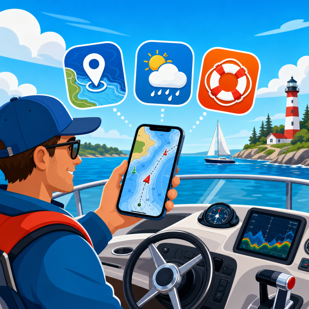
Modern boating apps have moved from nice-to-have conveniences to core equipment for captains who want better navigation, sharper weather awareness, and stronger on-the-water safety. In the broader world of boating gear and equipment, electronics and navigation systems now include far more than fixed chartplotters, VHF radios, and radar displays. A smartphone or tablet loaded with the right marine software can function as a route planner, backup chart system, AIS viewer, tide reference, anchor alarm, logbook, and emergency information center. I have used these apps in coastal cruising, inland runs, and offshore planning, and the difference between a generic map app and a purpose-built boating app is immediate: marine charts, depth contours, tide stations, hazard markers, and vessel-specific routing all appear where boaters actually need them.
Boating apps matter because they reduce friction in decisions that directly affect safety and efficiency. A skipper leaving before sunrise needs current weather windows, wind direction, sunrise timing, and route guidance in one place. An angler running across unfamiliar water needs contour detail, waypoints, and offline charts that still work when cell service drops. A family cruiser anchoring overnight needs drag alerts, tide forecasts, and the ability to share location. The best boating apps do not replace sound seamanship, paper backups, or installed marine electronics, but they dramatically improve situational awareness. This hub article covers the top boating apps for navigation, weather, and safety, while also explaining how they fit into a complete electronics and navigation system stack.
To choose well, it helps to define the categories. Navigation apps focus on marine charts, route planning, tracking, and waypoint management. Weather apps provide marine forecasts, radar, wind models, wave data, lightning information, and route timing support. Safety apps and safety features include AIS traffic display, EPIRB and MMSI references, float-plan tools, location sharing, emergency contacts, geofencing, and anchor alarms. Some leading platforms combine all three. Others do one job exceptionally well and work best alongside chartplotters from Garmin, Raymarine, Simrad, Lowrance, or B&G. The practical goal is not to find one perfect app for every boater. It is to build a reliable, layered system that matches your boat, waterway, cruising style, and tolerance for risk.
This article serves as a hub for electronics and navigation systems by showing where each app fits, what problem it solves, and what limitations you should expect. It also points toward deeper topics you would normally explore in related guides, such as chartplotters versus tablets, marine VHF setup, AIS transceivers, fish finders, battery management for mobile devices, and waterproof mounting solutions. If you are updating your boating gear and equipment, start with apps that improve three things first: where you are, what the weather is doing, and what you will do if conditions change fast.
Best boating navigation apps and what they do well
For pure navigation, Navionics Boating remains one of the most widely used and easiest to recommend apps because it combines detailed vector charts, sonar charts, autorouting support, dock-to-dock planning, community edits, and robust offline use. In real use, its value shows up before departure and while underway. You can plot routes on a tablet at home, sync them, then review depth shading and marina information at the dock. The depth color customization is especially useful on boats with known draft limits, because it turns theoretical chart data into a fast visual warning system. Navionics also benefits from broad familiarity; if you cruise with other skippers, there is a good chance they already understand the interface.
Garmin ActiveCaptain is strongest for boaters already invested in Garmin electronics. It works less like a standalone replacement and more like a bridge between mobile planning and installed systems. You can transfer routes and waypoints, update charts and software, view smart notifications, and manage data from a phone or tablet. On a cruising boat with a Garmin multifunction display, this cuts down repetitive work and keeps route planning consistent across devices. The tradeoff is clear: if you do not own Garmin hardware, much of ActiveCaptain’s advantage disappears. For Garmin users, however, it can turn mobile devices into practical extensions of the helm.
savvy navvy has gained attention because it simplifies marine route planning in a way many newer boaters immediately understand. Instead of making users mentally combine chart symbols, tides, weather, and pilotage notes across multiple screens, it presents route timing and passage planning in a streamlined interface. That simplicity is not trivial. Cognitive load matters when planning a tidal passage or threading a busy harbor entrance. On the other hand, experienced navigators should still validate any automated route suggestion against Notices to Mariners, local hazards, bridge constraints, and the boat’s draft and air draft. Clean design is helpful, but no app can see every uncharted object or temporary obstruction.
For anglers and inland boaters, C-MAP and Fishbrain often support a different style of use. C-MAP offers charting, route tools, and marina information, while Fishbrain layers in social catch data, maps, and species-focused features. These are not one-to-one substitutes for coastal navigation platforms, but they can be excellent additions for lake fishing, river running, and local knowledge gathering. The central lesson is that navigation app choice should reflect boating context. A center console running offshore for tuna, a pontoon on a reservoir, and a trawler cruising the Intracoastal Waterway do not need the same data density or workflow.
| App | Best For | Core Strength | Main Limitation |
|---|---|---|---|
| Navionics Boating | General coastal and inland navigation | Detailed charts, offline use, route planning | Advanced features require a subscription |
| Garmin ActiveCaptain | Garmin electronics owners | Device integration, route and update management | Best value depends on Garmin hardware |
| savvy navvy | Simple passage planning | User-friendly routing with weather and tides | Automation still requires skipper verification |
| C-MAP | Cruising and marina discovery | Chart tools plus points of interest | Coverage and features vary by region |
Top marine weather apps for route timing and risk reduction
Weather decisions sink more boating plans than mechanical faults, and the best marine weather apps help captains avoid false confidence. Windy is a standout because it visualizes multiple forecast models, including ECMWF and GFS, in a way that makes trend comparison fast. That matters when a bay crossing looks acceptable under one model and marginal under another. Windy also layers radar, gusts, cloud base, wave forecasts, and pressure, making it useful for both day trips and longer passages. I have found it especially helpful for identifying whether a calm morning departure is likely to turn into a punishing upwind return by early afternoon.
PredictWind goes further for serious passage planning. It is built around marine use, with high-resolution wind and wave forecasts, routing tools, departure planning, and offshore communication options. Offshore sailors and long-range cruisers value it because it treats weather as a route optimization problem rather than just a forecast display. If you are deciding whether to leave now, delay twelve hours, or adjust to a different harbor, that distinction is significant. PredictWind can feel deeper than a casual boater needs, but depth is exactly what many coastal and offshore operators require when fuel range, sea state, and crew comfort all depend on timing.
NOAA-based weather sources remain essential in the United States. The National Weather Service marine forecast, NOAA radar products, and official warnings should anchor your decision-making even if a commercial app provides a cleaner interface. Many third-party apps repackage this information, but the official source matters because advisories, special marine warnings, and forecast discussions explain confidence levels and local hazards. For example, a simple wind forecast might not fully express the impact of a strong opposing current at a harbor inlet, while local marine text products often highlight exactly that issue. The best practice is to compare at least one polished app with one official forecast source before departure.
Weather routing also has hard limits. Radar can lag, convective cells can build faster than expected, and local topography can distort conditions. Apps are strongest when they answer practical questions: What wind speed and direction should I expect at the exact time of my crossing? How will tide and current interact with that wind? Is there thunderstorm risk during my return window? Is a narrow pass likely to stack waves dangerously on an ebb? If your weather app does not help answer those questions clearly, add another source rather than assuming one display is enough.
Safety apps and features every boater should evaluate
Safety on the water depends on communication, visibility, and redundancy, and app features now support all three. One of the most useful functions is AIS display on mobile devices. Apps that show nearby vessel traffic can improve situational awareness in shipping lanes, fog, or busy inlets, especially when paired with a real AIS receiver or integrated onboard system. MarineTraffic is widely recognized for vessel tracking and port activity, though boaters should understand that app-based coverage can depend on shore receivers, satellite services, or transmitted data access. It is informative, not a substitute for your own radar watch, AIS transceiver, or visual lookout.
Anchor alarm apps deserve more attention than they get. For overnight anchoring, a well-configured alarm using GPS position, swing radius, and local chart context can provide genuine peace of mind. The key is correct setup. If you do not account for scope, changing wind direction, and GPS drift, false alarms become so frequent that crews start ignoring them. I have seen good results when boaters test the radius in daylight, compare the app against the actual anchor set, and keep the device powered continuously. A dedicated chartplotter anchor alarm is often preferable, but a phone or tablet alarm remains a valuable backup.
Float-plan and location-sharing tools are another major benefit. The safety gain is simple: someone on shore knows where you intended to go, when you expected to return, and whom to call if you do not check in. Some boating apps include trip sharing directly, while others rely on general messaging or tracking integrations. This is particularly useful for solo anglers, small-boat operators, and trailer boaters moving between ramps. The best systems include vessel description, registration number, crew list, communication methods, tow vehicle details, and alternate destinations. In an actual overdue-vessel situation, those details matter far more than a vague statement that you went fishing offshore.
No app replaces distress hardware. A DSC-enabled VHF radio connected to GPS, a registered EPIRB or personal locator beacon where appropriate, navigation lights, and a charged handheld backup are still baseline safety gear. Apps support awareness and coordination; they do not replace regulated emergency systems designed to work when phones fail, batteries die, or a vessel is taking on water. The smart approach is layered safety: app, radio, chartplotter, paper chart, and emergency beacon each covering a different failure mode.
How to build a reliable app setup around your onboard electronics
The most effective boating app strategy is not to download everything. It is to assign roles. Start with one primary navigation app, one dedicated weather source, and one safety or tracking tool. Then connect those choices to your existing electronics and navigation systems. A bay boat with a single multifunction display might use Navionics for planning, Windy for forecast comparison, and a simple float-plan routine through a family contact. A cruising sailboat with radar, AIS, and a B&G or Raymarine network might pair onboard displays with PredictWind, ActiveCaptain or vendor-specific integration, and a tablet running independent backup charts below deck.
Hardware setup matters as much as software selection. Marine apps are only trustworthy if the device is visible, powered, and protected. Use a waterproof case rated appropriately, a secure mount that can handle pounding chop, and a charging solution that matches real use. Wireless charging sounds convenient but often underperforms in heat and spray; a wired, marine-grade power connection is usually more reliable. Screen brightness is another overlooked factor. A navigation app is of little value if midday glare makes contour lines unreadable. Test devices in direct sunlight before relying on them underway.
Offline capability is non-negotiable. Download charts, forecast snapshots where possible, and route data before leaving coverage. Cellular dead zones are routine along coastlines, rivers, and large lakes, and they arrive exactly when many boaters expect an app to work. I recommend a simple pre-departure checklist: update the app, confirm subscriptions are active, cache charts for the operating area, charge devices to full, verify GPS permissions, and test location accuracy at the dock. This five-minute routine prevents many common failures blamed on the app when the real issue is preparation.
Data consistency also matters. If your chartplotter, app, and paper references disagree on waypoint names, route revisions, or datum assumptions, errors compound quickly. Standardize how you label routes and hazards. Use recognizable names, not cryptic abbreviations you will forget under stress. When moving data between systems, confirm positions visually rather than assuming imports are flawless. Electronics and navigation systems are powerful because they reduce workload, but only when the information inside them is organized and current.
Choosing the right boating apps for your style of boating
The best boating apps for navigation, weather, and safety depend on where and how you operate. Coastal cruisers usually need detailed charting, tide support, marina information, and weather model comparison. Offshore anglers need route confidence, sea-state forecasting, backup navigation, and strong tracking discipline. Inland boaters may prioritize ramp information, shallow-water awareness, and localized storm alerts. Sailors often put extra emphasis on wind layers, routing, and anchor management. Commercial operators or delivery crews usually care most about reliability, AIS awareness, redundancy, and integration with established helm electronics.
Cost should be judged against consequences, not app-store price alone. A subscription that prevents one bad weather departure, one grounding in poorly understood shallows, or one wasted fuel run often pays for itself quickly. At the same time, more expensive is not automatically better. Some boaters oversubscribe to overlapping services they never fully use. Start with the operating problems you actually have. If your biggest issue is uncertain thunderstorms, invest in marine weather depth. If your stress point is unfamiliar channels, invest in better charting and route planning. If you anchor often, prioritize alarm reliability and power management.
As the electronics and navigation systems category continues to evolve, boating apps are becoming central pieces of the toolkit rather than afterthoughts. The strongest setup combines purpose-built navigation, credible weather intelligence, and practical safety features, all backed by sound seamanship and marine-grade hardware. Navionics Boating, Garmin ActiveCaptain, savvy navvy, Windy, PredictWind, MarineTraffic, and specialized anchor or tracking tools each solve different problems well. The right answer is rarely a single app. It is a carefully chosen stack that matches your boat, cruising grounds, and risk profile.
If you are upgrading your boating gear and equipment, begin by auditing your current process for navigation, weather checks, and emergency planning. Identify the gaps, choose apps that close them, and test them before you need them. A smarter electronics and navigation system starts with better information, and the best boating apps deliver exactly that when configured with care.
Frequently Asked Questions
What are the most important features to look for in a boating app for navigation, weather, and safety?
The best boating apps do more than show your position on a map. For navigation, look for reliable marine charts, GPS tracking, route planning, waypoint management, depth contours, tide and current data, and offline chart access so you can still navigate when cellular service disappears. Many boaters also value AIS integration or AIS overlays, which can help identify nearby commercial traffic and other equipped vessels in busy waterways. A strong app should also make it easy to measure distances, estimate arrival times, and switch between chart views depending on the type of boating you do.
For weather, the key features include real-time radar, marine forecasts, wind speed and direction, wave height, storm alerts, lightning tracking, and hourly forecast detail tailored to coastal or offshore conditions. General weather apps may be useful, but marine-focused apps are often better because they present data that matters to boaters, such as swell period, gust potential, and changing conditions over open water. Safety features can include anchor drag alarms, man-overboard marking, float plan tools, emergency contact sharing, and integration with onboard electronics. The strongest apps combine ease of use with dependable data, because in real boating conditions, speed and clarity matter just as much as the size of the feature list.
Can a boating app replace a dedicated chartplotter or other onboard marine electronics?
In many situations, a boating app can serve as an excellent navigation tool, but it should not automatically be treated as a complete replacement for dedicated marine electronics. A modern app on a smartphone or tablet can handle route planning, chart viewing, GPS positioning, weather checks, tide lookups, and even some AIS functions. For small boats, day cruisers, kayaks, and inland or nearshore boaters, that may be enough for many trips. Apps are especially valuable as flexible, portable systems that are easy to update and often cost far less than a full fixed-mount setup.
That said, dedicated chartplotters and marine electronics still offer clear advantages in durability, screen brightness, waterproofing, integration, and reliability. Fixed units are designed for harsh marine environments, direct sunlight, constant vibration, and long operating hours. They can also tie directly into radar, sonar, autopilot, NMEA networks, and onboard power systems in ways many mobile apps cannot fully match. A smart approach is to use boating apps as part of a layered system rather than an all-or-nothing substitute. Many experienced captains use an app for trip planning and backup navigation while relying on dedicated helm electronics as the primary system. Redundancy is a major part of boating safety, and an app is often most valuable when it complements, rather than replaces, your core equipment.
Why is offline access so important in marine navigation apps?
Offline access is one of the most important features in any serious boating app because cellular coverage on the water can be inconsistent, weak, or completely unavailable. Even on lakes, bays, and popular coastlines, signal strength may drop exactly when you need chart detail, route information, or hazard awareness most. If charts, tide stations, and route data are not stored on the device ahead of time, an app can become far less useful at the worst possible moment. That is why experienced boaters download charts and relevant cruising regions before leaving the dock.
Offline capability also improves confidence and decision-making. When chart layers, saved routes, and waypoints are available locally, you can continue navigating even if weather conditions deteriorate or your connection fails offshore. Some apps also let you cache weather models, harbor information, and points of interest for later use, which can be helpful during longer passages. The practical takeaway is simple: a boating app should never depend entirely on a live internet connection to perform core tasks. Before every trip, confirm that charts are downloaded, the app is updated, the device GPS works without service, and essential information is accessible in airplane mode. That preparation turns a boating app from a convenience into a dependable backup tool.
How do boating apps improve weather awareness and decision-making on the water?
Boating apps can dramatically improve weather awareness because they put marine-specific forecast information in front of the captain quickly and in a format that is easier to interpret while planning or underway. Instead of relying only on a general forecast, you can review wind shifts, gust trends, precipitation timing, radar movement, wave heights, tides, currents, and lightning risk in a more location-specific way. That helps boaters decide when to leave, whether to change a route, when to seek shelter, and whether conditions are suitable for less experienced passengers or smaller vessels.
The biggest advantage is not just access to more data, but the ability to compare conditions over time. Good weather apps show hourly changes and often visualize incoming fronts or building wind conditions before they become obvious on the water. A captain might notice that calm morning conditions are expected to turn into strong afternoon winds with steep chop, or that a thunderstorm line is likely to cross the route before the planned return. That kind of visibility supports better go-or-no-go decisions and more conservative seamanship. Still, weather apps should be used thoughtfully. Forecasts can change, and no app eliminates the need for visual observation, VHF weather monitoring where available, and basic judgment about your boat’s limitations and your crew’s experience level.
What safety best practices should boaters follow when using apps on a smartphone or tablet?
Boating apps are most effective when they are treated as part of a larger safety system rather than as a single solution. Start by protecting the device itself: use a waterproof case, secure mount, screen shade if needed, and an external power source or charging setup because navigation and GPS use can drain batteries quickly. Set up offline charts, pre-load routes, save important waypoints, and test the app before departure. It is also wise to carry more than one device if possible, such as a phone and a tablet, so a dead battery, overheated screen, or damaged unit does not leave you without digital navigation.
Beyond the device, follow classic seamanship principles. Keep paper charts if appropriate for your area, know how to use a compass, maintain a VHF radio for communication, and never rely on one source of information for navigation or weather. Use app-based anchor alarms, float plan tools, and location sharing features where helpful, but make sure someone ashore knows your plan independently. If your app supports man-overboard marking, emergency coordinates, or AIS viewing, learn those functions before an emergency happens. The main goal is not simply to have boating apps onboard, but to integrate them into a disciplined safety routine. When used that way, they can significantly improve awareness, preparedness, and confidence on the water.