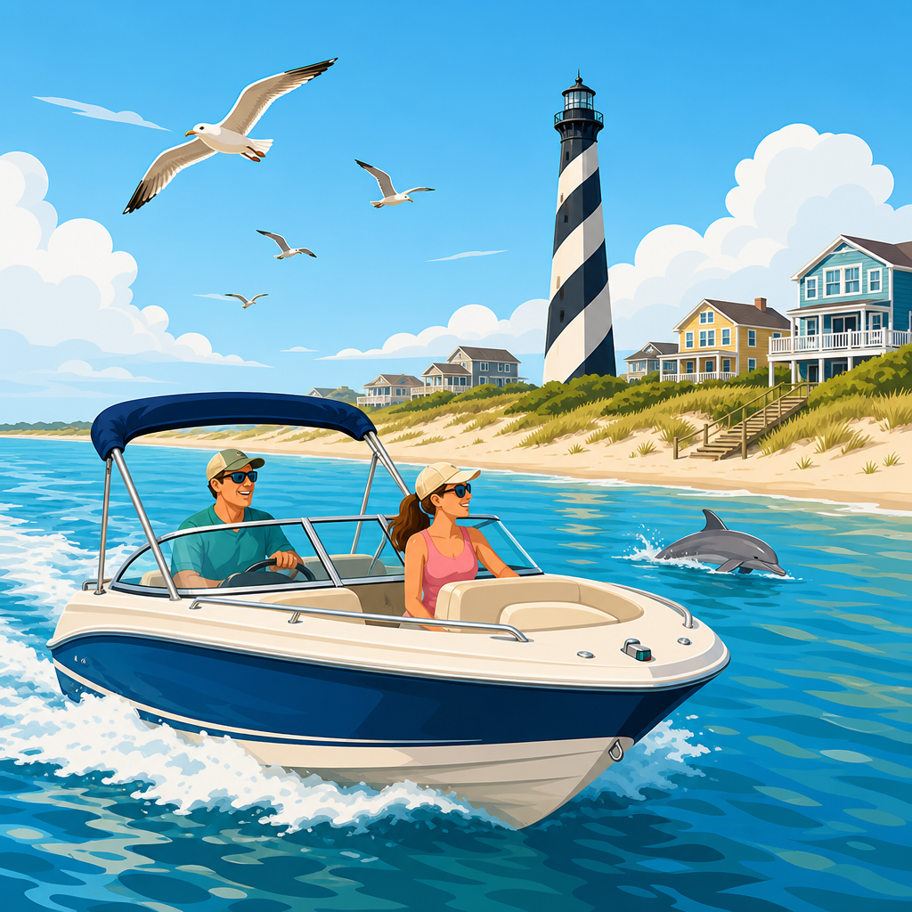
The Outer Banks is one of the best places on the East Coast to learn coastal cruising and island hopping because it compresses almost every boating challenge into one long, narrow chain of barrier islands. You get shifting inlets, tidal current, shoaling sounds, ferry routes, protected anchorages, weather that can change in a few hours, and small harbors that reward careful planning. When I plan a trip here, I treat the region as a practical training ground as much as a vacation destination. A cruiser who understands the waters around Corolla, Roanoke Sound, Oregon Inlet, Hatteras, Ocracoke, and the approaches toward Beaufort develops habits that transfer almost anywhere along the Atlantic Intracoastal Waterway.
To cruise the Outer Banks by boat means moving through a mix of inland sounds, marked channels, marinas, public docks, anchorages, and weather windows while using current charts, tide data, and local knowledge. Coastal cruising refers to passage-making along shore within reach of safe harbors, usually with day runs planned around wind, sea state, and fuel. Island hopping means shorter legs between stops where the destination is part of the experience: a village dock, a beach anchorage, a ferry town, or a wildlife refuge edge. In the Outer Banks, those two styles overlap. You may run a protected section of the Intracoastal route one day, then cross open Pamlico Sound or round a weather-sensitive inlet the next.
This matters because the Outer Banks can be extraordinarily rewarding and unforgiving at the same time. The same shallow waters that create calm anchorages also move sandbars across channels. The same barrier islands that deliver postcard beaches also expose inlets to ocean swell. A good trip is rarely about speed. It is about preparation, route discipline, and knowing when to stay put. This guide works as a hub for coastal cruising and island hopping across the region, showing how to choose the right boat, build a route, navigate safely, and make each stop count.
Understand the Outer Banks cruising environment
The first step is understanding the geography. The Outer Banks stretches roughly 200 miles along North Carolina, separating the Atlantic Ocean from Currituck Sound, Albemarle Sound, Roanoke Sound, Croatan Sound, Pamlico Sound, and Core Sound. For boaters, that means there is no single “Outer Banks route.” There are several connected cruising zones, each with different depths, fetch, and infrastructure. The northern waters near Coinjock and Manteo are popular for Intracoastal travelers because they offer protected transit and reliable marina services. Farther south, Hatteras and Ocracoke open the door to more exposed passages, fishing culture, and classic island hopping.
Conditions here are shaped by shallow water. Large areas of Pamlico Sound average only 15 to 20 feet deep, and many cruising grounds are much shallower. Wind against current can quickly stack short, steep waves that feel worse than the forecast suggests. A 20-knot southwest breeze across a long fetch in the sound can turn a comfortable morning into a punishing afternoon. I have seen crews underestimate this because they associate “sound” with sheltered water. In the Outer Banks, shelter depends on depth, direction, and fetch, not just whether land surrounds you on a chart.
Navigation is equally distinctive. Inlets such as Oregon Inlet are known for shoaling and can change materially after storms. The U.S. Coast Guard, U.S. Army Corps of Engineers, and NOAA provide updates, but local marina reports often tell you what the official notices do not capture in real time. That is why prudent skippers combine NOAA charts, Coast Pilot guidance, ActiveCaptain notes, and direct calls to harbormasters or towing operators before committing to a route. Electronic charts are essential, but in these waters they are not enough by themselves.
Choose the right boat and equipment for island hopping
The best boat for cruising the Outer Banks is not necessarily the largest. Draft, range, protection from spray, and ease of anchoring matter more than headline length. Center consoles from 24 to 32 feet are common because they can handle day runs, beach landings, and fishing. Pilothouse boats and downeast designs add comfort in shoulder seasons when wind and spray become tiring. Trawlers and cruising sailboats work well on the Intracoastal and in deeper harbors, but shoal draft remains an advantage almost everywhere. If your boat draws more than five feet, route selection becomes far narrower, especially around secondary anchorages and side trips.
Equipment choices should reflect local realities. A modern chartplotter with updated NOAA cartography, radar, a VHF with DSC, and a reliable depth sounder are baseline tools, not luxuries. I also consider a windlass close to essential because many stops involve anchoring, and repeated manual retrieval in shifting conditions wears crews down. Carry primary and backup navigation apps, but do not rely on cellular service alone. In remote parts of Core Sound and southern Pamlico, coverage can thin out. A paper chartbook is still useful for broad route awareness and contingency planning.
Ground tackle deserves special attention. Sandy bottoms are common, but holding can vary with grass and current. A correctly sized scoop anchor, adequate chain, and enough rode for changing depth make the difference between a restful evening and a midnight reset. Safety gear should exceed minimum carriage rules. I want spare fuel filters, a tow membership, a mounted spotlight, a first-aid kit suited for hooks and cuts, and a ditch bag if the route includes inlet crossings. Summer thunderstorms build quickly here, so canvas, clear weather data, and a conservative crew briefing are practical gear, too.
Plan your route, timing, and stop sequence
Most successful Outer Banks itineraries start by matching cruising style to geography. If you want easy marina access and shorter protected runs, focus on the northern section: Coinjock, Manteo, Wanchese, and nearby day trips through Roanoke and Croatan sounds. If you want the fullest island hopping experience, build around Hatteras, Ocracoke, and the villages connected by Pamlico Sound. Longer expeditions may continue toward Cedar Island, Beaufort, or the Core Banks. Distances are manageable on paper, but weather windows often dictate where you can realistically go next.
A simple planning framework keeps decisions grounded. First, identify your overnight options before your daily mileage. Second, note controlling depths and bridge clearances if relevant. Third, check wind direction, not just wind speed, against the open-water legs. Fourth, confirm fuel availability because marina hours vary outside peak season. Fifth, build a margin day. In my experience, Outer Banks trips become enjoyable when the itinerary can absorb one weather hold without collapsing. The mistake I see most often is trying to force a fixed reservation schedule through a region defined by changing conditions.
| Leg | Typical appeal | Main planning concern | Best fit |
|---|---|---|---|
| Coinjock to Manteo | Protected transit, marina services, easy provisioning | Traffic and channel awareness | First-time cruisers |
| Manteo to Hatteras area | Classic Outer Banks scenery, fishing ports, longer days | Weather and route depth | Experienced coastal boaters |
| Hatteras to Ocracoke | Signature island hop, village atmosphere, anchoring options | Wind over shallow sound | Cruisers seeking short adventurous legs |
| Ocracoke to Cedar Island or Beaufort approaches | Remote water, wildlife, transition to southern coast | Exposure and limited services | Independent crews with range |
Season matters as much as route. Late spring and early fall are often ideal because temperatures are moderate and traffic is lighter than midsummer. Summer brings warm water and full services, but also thunderstorms, heat, crowded docks, and tropical weather risk. Shoulder seasons can be superb for experienced crews, though shorter daylight and stronger frontal passages require sharper timing. Whatever month you choose, book popular slips early in Ocracoke and Manteo, then confirm by phone shortly before arrival.
Navigate safely through sounds, inlets, and harbors
Safe navigation in the Outer Banks starts with one rule: stay in the marked channel unless you have current local knowledge and a reason to leave it. Shoals migrate constantly, and water color can mislead in glare or afternoon chop. I tell crews to zoom out before they zoom in. On a chartplotter, broad context reveals doglegs, shoal shelves, ferry crossings, and bailout creeks that disappear when you run on a tight scale. Then zoom in for the next mark, verify with depth, and keep the route dynamic rather than blindly following a magenta line.
Inlets demand special caution. Oregon Inlet, Hatteras Inlet, and Ocracoke Inlet can all be manageable or nasty depending on swell, current, dredging status, and recent weather. Before any inlet transit, review the latest Local Notice to Mariners, check wave period as well as height, and ask a local operator what the bars look like that day. If you are not experienced with shifting East Coast inlets, there is no shame in staying inside the sounds and building an island-hopping trip without an ocean leg. Prudence is normal seamanship here, not timidity.
Harbor approaches are usually straightforward but busy. Wanchese handles commercial traffic. Hatteras and Ocracoke see ferries, charter boats, and recreational traffic converging in tight areas. Keep VHF volume up, maintain a proper lookout, and avoid drifting while crews sort lines and fenders at the last minute. Tidal range is modest compared with New England, but current around cuts and channels still matters. Night operation adds difficulty because unlit hazards, background shore lights, and crab pot markers can reduce your margin quickly. Unless you know the route well, aim to arrive with daylight to spare.
Build a practical island-hopping itinerary
A strong Outer Banks itinerary balances motion and time ashore. Manteo works well as a starting point because it combines protected water, repair capability, groceries, and walkable attractions on Roanoke Island. From there, many crews day-cruise to Wanchese for seafood and charter-boat atmosphere before committing south. Hatteras offers a different tone: workboats, offshore fishing heritage, and access to broad Pamlico waters. Ocracoke is the emotional center of many trips, with a harbor that makes boaters slow down, walk the village, and stay longer than planned.
For a four- to six-day trip, one proven pattern is Manteo to Hatteras area, Hatteras to Ocracoke, a lay day in Ocracoke, then either return north or continue toward Cedar Island depending on weather. Another excellent option is to keep the entire trip around Ocracoke and Hatteras, using short hops and anchoring to reduce schedule pressure. Families often do better with fewer miles and more swimming, shelling, and dockside meals. Fishing-focused crews may center on Hatteras and make Ocracoke the scenic stop rather than the operational base. The right itinerary is the one your crew can execute comfortably.
When choosing stops, think in layers. First layer: fuel, water, shore power, pump-out, and groceries. Second layer: protection from prevailing wind. Third layer: what makes the stop memorable, such as a lighthouse view, a beach accessible by dinghy, or a village with bike rentals. This layered approach prevents a common mistake in destination cruising: choosing photogenic stops that become frustrating because they do not support the boat or the crew. In the Outer Banks, comfort and logistics are part of the adventure, not separate from it.
Handle weather, docking, and daily boat operations
Weather management is the skill that most separates smooth Outer Banks cruises from stressful ones. Morning conditions are often calmer, especially in summer before thermal winds and thunderstorms build. I prefer early departures, firm decision times, and a written threshold for changing plans, such as sustained wind over a set value for a specific exposed leg. Use NOAA Marine Forecasts, buoy observations, radar, and at least one high-resolution model source. Forecast apps are useful, but raw marine products still matter because they describe zones and hazards in language tailored to navigation.
Docking requires preparation because many stops have current, wind exposure, or traffic pressure. Rig lines and fenders before entering the harbor, assign roles clearly, and brief the crew on aborting a landing if the angle goes wrong. At popular village docks, expect spectators and tight maneuvering; neither should change your process. Anchoring calls for the same discipline. Check swing room, set the anchor with intent, verify holding by landmarks and electronics, and account for wind shifts overnight. If thunderstorms are likely, leave more space and reduce complacency simply because other boats look settled.
Daily operations also shape the trip. Top off fuel when convenient rather than when necessary. Flush engines if facilities allow after salty or silty runs. Check strainers, bilge, battery state, and weather before dinner instead of at sunrise. Respect no-wake zones because shoreline erosion and small working craft are real issues in these communities. Finally, give yourself permission to stop early. Some of my best Outer Banks days ended before noon because the anchorage was perfect, the village was interesting, and pushing farther would only have converted a good day into a rushed one.
The Outer Banks rewards boaters who approach it as a chain of distinct cruising environments rather than one continuous route. Learn the geography, choose a boat that suits shallow water and changing weather, and plan around overnights, fuel, and wind direction before you think about mileage. Stay in marked channels, treat inlets with respect, and use local knowledge alongside NOAA charts and official notices. Build your itinerary so each leg is achievable, each stop is useful, and at least one day can absorb delays without wrecking the trip. That is the practical formula behind safe, enjoyable coastal cruising and island hopping here.
The bigger benefit is confidence. Once you have handled a short sound crossing in fresh breeze, anchored securely in a shifting current, timed a harbor arrival, and adjusted a route because conditions changed, you become a more capable cruiser everywhere else. The Outer Banks teaches judgment in a way few destinations can. Start with a modest itinerary, keep your options open, and let the region set the pace. If you are planning your next boating destination, use this guide as your hub, then map your first leg, call your first marina, and begin building an Outer Banks cruise that fits your boat and your crew.
Frequently Asked Questions
1. What makes the Outer Banks such a good place to learn coastal cruising by boat?
The Outer Banks is an unusually effective training ground because it combines many of the real-world conditions boaters need to learn in a relatively compact region. Instead of running one long offshore passage or staying inside a completely protected waterway, you are constantly balancing changing inlets, shallow sounds, local wind shifts, marked channels, ferry traffic, and anchorages that can feel calm one hour and exposed the next. That variety teaches practical seamanship quickly. You are not just driving from point A to point B; you are learning how to read water, plan routes around tide and depth, evaluate weather windows, and make small decisions that have a big impact on safety and comfort.
Another reason the area works so well for skill-building is that the navigation demands attention without requiring a major expedition. A short cruise can include marsh creeks, open sound crossings, busy harbor approaches, and narrow channels with shoaling on either side. That means every day on the water becomes a lesson in route management. You begin to understand why chart study matters, why local knowledge matters, and why cruising speed alone never replaces planning. For newer cruisers, the Outer Banks offers enough complexity to build confidence, but also enough harbors, towns, and stopping points to keep the trip manageable.
Just as important, the region rewards careful preparation. If you check the forecast, study the chart, confirm your fuel range, identify protected alternatives, and time your movements intelligently, your trip usually goes much more smoothly. That makes the Outer Banks ideal for learning disciplined cruising habits. It is a place where good planning pays off immediately, and where sloppy planning can become uncomfortable very fast. For anyone wanting to develop sound judgment in coastal boating, that combination is incredibly valuable.
2. What kind of trip planning should I do before cruising the Outer Banks by boat?
Start with route planning, but do not stop there. Before departure, map out your intended legs, likely fuel stops, overnight options, safe harbors, and backup anchorages in case weather changes or a channel becomes less favorable than expected. The Outer Banks may look simple on a map because it is a long chain of barrier islands, but on the water it is much more nuanced. Water depth can change quickly, inlets can shift, and a route that appears direct may be less practical than a slightly longer run through better-marked water. Build your plan around current chart data, local notices, and realistic daily distances rather than optimistic assumptions.
Weather planning is equally important. This is not an area where you want to glance at a forecast once and consider the job done. Wind direction can dramatically change conditions in the sounds and anchorages, and a forecast that seems acceptable in the morning can produce a rough, exposed crossing by afternoon. Check marine forecasts repeatedly, pay attention to frontal timing, and think in terms of weather windows. If a strong wind shift is expected, ask how it will affect both your route and your overnight stop. A comfortable anchorage in one direction can become a poor choice after the wind swings.
You should also plan around your boat’s draft, fuel burn, and operating style. A shallow-draft boat may have more flexibility in the sounds, while a deeper-draft cruiser may need to be stricter about staying in marked channels and timing certain legs carefully. Know your real fuel consumption at cruising speed, not just the best-case number. Confirm where fuel is available and whether docks can accommodate your boat. Finally, prepare your crew. Everyone should understand basic line handling, fender placement, lookout duties, and what to expect during docking, anchoring, and channel transits. A successful Outer Banks cruise is usually the result of layered planning: charts, weather, depth, fuel, stops, and crew readiness all working together.
3. How do I deal with shallow water, shoaling, and shifting channels in the Outer Banks?
The first rule is to respect how dynamic this region is. Shoaling is not an occasional inconvenience here; it is part of the boating environment. Sand moves, channels evolve, and some areas that were comfortable last season may demand much more caution now. That means you should rely on up-to-date charts and local information, but also understand that no chart can substitute for active situational awareness. Watch your depth sounder continuously, stay alert to markers, and avoid assuming the deepest-looking water is actually the best route if the charted channel says otherwise.
In practice, that means running conservatively and deliberately. Keep speed at a level that gives you time to interpret what you are seeing, especially in unfamiliar or narrow water. Follow aids to navigation carefully, but do so with your eyes open, because even well-marked routes can be affected by recent bottom changes. If you are running in a group or behind another boat, do not blindly copy its path. Draft, speed, and local familiarity may differ. Make decisions based on your boat and your instruments. When conditions are uncertain, slow down, post a good lookout, and be willing to turn around rather than push into questionable water.
Timing can help as well. Some cruisers prefer moving through known shallow areas with more water under the keel when possible, but that depends on tide, wind setup, and the specific waterway. You should never assume tide alone will solve a routing problem in the sounds, because wind can affect water levels significantly. Most importantly, build caution into your mindset. In the Outer Banks, smart boaters treat depth as an active variable throughout the day, not a box checked during pre-departure planning. That habit reduces stress, prevents groundings, and makes the entire trip more predictable.
4. What are the biggest safety and navigation concerns when island hopping through the Outer Banks?
The biggest concern is the combination of changing weather and shallow, exposed water. A route that feels easy in settled conditions can become uncomfortable or even unsafe when the wind builds against current or across open sound water. Because the Outer Banks includes both protected sections and exposed crossings, you need to evaluate each leg in context rather than assuming the whole trip will behave the same way. A calm morning departure does not guarantee an easy afternoon arrival. Build safety margins into your timing so you are not forced to complete a tricky leg in worsening conditions.
Traffic is another important factor. Ferry routes, fishing boats, local traffic, and recreational boaters all share the same waters, and some areas can become surprisingly busy. Maintain a disciplined lookout and know where ferries operate so you can stay predictable and clear of their path. In tighter channels, your margin for error may already be reduced by shoaling, so traffic management becomes part of route management. Good communication on board helps a lot here. If one person is watching the chartplotter and another is scanning ahead for markers, traffic, or shoal indicators, you are much less likely to get overloaded in a busy section.
Anchoring and overnight decisions are also safety issues, not just comfort choices. Protected anchorages are one of the pleasures of cruising the Outer Banks, but protection depends heavily on wind direction and fetch. Choose spots based on the forecast for the full night and next morning, not just the conditions you see on arrival. Set your anchor carefully, verify holding, and confirm you have swing room if the wind shifts. Finally, always keep alternatives in mind. The safest cruisers in this region are the ones who are willing to modify the plan early. If an inlet looks questionable, the forecast deteriorates, or a destination no longer makes sense, changing course is good seamanship, not failure.
5. What is the best way to structure a step-by-step Outer Banks cruise for a beginner?
The best approach is to keep the trip intentionally simple at first and treat each day as a controlled lesson. Begin with short legs between well-understood stops rather than trying to cover a large portion of the Outer Banks in one ambitious itinerary. Pick a starting harbor with straightforward services, review your route the night before, and identify one primary destination plus at least one backup stop. That structure lowers pressure and helps you make calm decisions on the water. You want enough challenge to learn, but not so much complexity that every leg becomes rushed or reactive.
A practical beginner sequence often looks like this: first, study charts and forecasts and choose a short route with manageable depths and a clear overnight destination. Second, depart early enough to give yourself daylight, flexibility, and time for slower navigation in unfamiliar areas. Third, run at a pace that allows you to monitor markers, depth, and traffic without feeling behind schedule. Fourth, arrive with plenty of time to dock or anchor without rushing. Fifth, review the day afterward. Ask what worked, what felt uncertain, and what you would do differently on the next leg. That kind of debrief is how casual boating turns into real cruising skill.
As your confidence grows, add complexity gradually. Introduce a longer open-water crossing, a stop that requires more careful tide and depth awareness, or an anchorage selected specifically for forecast protection. The Outer Banks is ideal for this step-by-step progression because it offers variety without requiring you to leave the broader coastal system. Over time, you learn not only how to move the boat safely, but how to think like a cruiser: planning ahead, respecting weather, adapting to conditions, and making conservative decisions before problems develop. That is the real goal of a beginner cruise here. The destination is enjoyable,