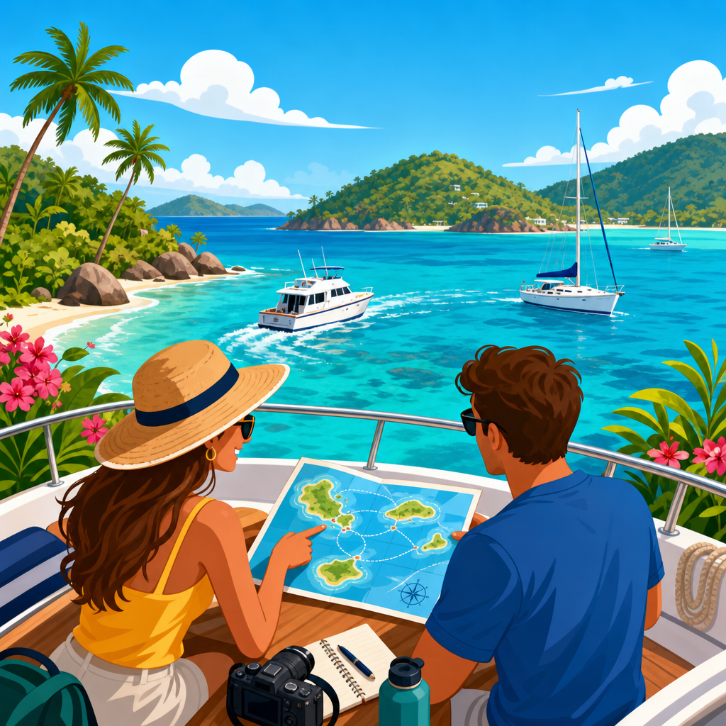
Coastal cruising in the United States combines practical seamanship, regional weather knowledge, and destination planning into one of the most rewarding ways to travel by boat. In simple terms, coastal cruising means navigating along shorelines, bays, sounds, and nearshore passages rather than making long offshore crossings, while island hopping focuses on short, manageable legs between anchorages, marinas, and coastal towns. I have planned and run these routes with a constant eye on tides, inlets, bridge clearances, fuel range, and safe weather windows, and the difference between a pleasant cruise and a stressful one almost always comes down to preparation. For boaters, this topic matters because the U.S. coastline offers extraordinary variety: New England harbors shaped by tides and fog, the Intracoastal Waterway linking protected stretches in the Southeast, coral-fringed passages in South Florida, and the Pacific coast’s more demanding swell, wind, and harbor spacing. A strong coastal cruising plan helps boaters choose the right vessel, season, route length, and stopping points, while also reducing avoidable risk. This hub covers the best coastal cruising routes in the U.S., how to compare them, and what makes each region distinct for island hopping, marina access, anchoring, provisioning, and scenic value.
How to Choose the Right Coastal Cruising Route
The best coastal cruising route depends on your boat, crew experience, and tolerance for weather exposure. A trawler with long range and full accommodations can handle multiweek passages very differently than a center console set up for day runs, and a sailing catamaran has different draft and bridge clearance considerations than a monohull or express cruiser. Before recommending any route, I usually start with six variables: average leg length, protected versus open water, tidal current strength, inlet reliability, fuel availability, and access to haul-out or repair services. Those factors quickly narrow the field.
Seasonality is just as important as geography. The U.S. East Coast follows a migratory rhythm shaped by hurricane season in the South and short summer windows in the North. Florida and the Keys are prime in winter and spring, while Maine is at its best in mid-summer through early fall. On the West Coast, the Pacific demands more caution because northwesterly wind, cold water, and limited all-weather harbors can turn a scenic trip into a slog. For newer cruisers, protected routes such as Florida Bay segments, the Chesapeake, Long Island Sound, and portions of the Intracoastal Waterway offer forgiving conditions and frequent bail-out points. For more experienced crews, Maine’s Down East coast and Southern California’s island chain provide richer rewards but demand sharper planning.
Navigation tools matter, and the standard setup today includes updated electronic charts from Garmin, Navionics, or C-MAP, backed by paper chart awareness and local notices to mariners. NOAA tide and current tables, ActiveCaptain marina reviews, Waterway Guide route planning, and forecast products from the National Weather Service should be treated as baseline resources, not optional extras. In practice, the best route is rarely the one with the most famous name; it is the one that matches your boat’s systems, your crew’s stamina, and the seasonal pattern you will actually face on the water.
Florida Keys: The Classic U.S. Island-Hopping Route
If one route defines coastal cruising and island hopping in the United States, it is the Florida Keys. Stretching from Biscayne Bay through Key Largo, Islamorada, Marathon, Big Pine Key, and Key West, this chain offers short hops, extensive marine services, and a cruising culture built around transient boaters. The route works for powerboats, cruising sailboats, and trailerable vessels launched into strategic sections. What makes it exceptional is flexibility: you can run the Atlantic side for clearer water and reefs, the Gulf side for more protection in certain conditions, and connect through channels depending on draft and weather.
Biscayne Bay and Elliott Key form an ideal starting point for boaters who want a gentle first leg. Farther south, Key Largo opens access to John Pennekamp Coral Reef State Park and nearby reef moorings, while Islamorada offers fishing heritage, dockage, and easy provisioning. Marathon is one of the most functional middle stops because Boot Key Harbor provides mooring fields, repair access, and a strong support network for transient cruisers. Key West finishes the route with historical character, deep boating infrastructure, and easy day trips to nearby anchorages.
The Keys require attention to depth, coral protection rules, and changing wind direction. Many anchorages are comfortable only in specific quadrants, and inexperienced skippers sometimes underestimate how quickly a fresh easterly can change a planned stop. Summer heat and hurricane risk also shape routing decisions. Still, for manageable distances, warm-water scenery, and year-round cruising appeal, no U.S. route delivers a better balance of accessibility and destination density.
Chesapeake Bay and Virginia Tidewater: Protected Water With Serious Range
The Chesapeake Bay is one of the most practical and rewarding coastal cruising grounds in the country because it combines large-scale navigation with relatively protected water. Running from the Virginia Capes north toward Annapolis, Baltimore approaches, the Eastern Shore, and tributaries such as the Potomac, Rappahannock, York, and Miles rivers, the bay supports weekend cruises and full-season exploration equally well. I often describe it as a cruising laboratory: boaters can refine anchoring, current management, and passage planning skills without committing to exposed offshore legs.
Key ports include Hampton, Deltaville, Solomons, Annapolis, St. Michaels, Oxford, and Rock Hall. Each provides a different mix of marina access, historic waterfronts, and sheltered creeks. Hampton is especially useful as a staging point for northbound or southbound movements because it connects offshore traffic, the Intracoastal Waterway, and bay cruising. Annapolis remains the cultural center for many sailors, but smaller towns often deliver the best overnight experiences because they offer quieter anchorages and easier dock access.
The tradeoff is that the bay is not always gentle. Southerly summer chop can build quickly over long fetches, thunderstorms can be severe, and shallow areas punish casual route changes. Tidal current is less dramatic than in some New England passages, but it still matters around river mouths and constrictions. Crab pots are another operational reality, particularly for sailboats with exposed running gear. Despite those issues, the Chesapeake is arguably the best all-around coastal cruising region for boaters who want variety, manageable legs, and a deep bench of marina and repair services.
New England Coast: Long Island Sound, Cape Cod, and Maine
New England offers the most layered coastal cruising in the U.S., but it also demands the most respect for tide, fog, cold water, and seasonal timing. Long Island Sound is the logical entry point for many crews because it blends protected cruising with a wide range of stops, from Mystic and Newport approaches to the Connecticut shore and eastern gateways toward Block Island, Fishers Island, and Gardiners Bay. Distances are manageable, harbors are frequent, and the area helps crews transition from casual day boating into real passage planning.
From there, boaters often branch toward Narragansett Bay, Martha’s Vineyard, Nantucket, Cape Cod, and eventually the Maine coast. Newport remains a flagship stop because of its harbor infrastructure and sailing culture, but the route beyond Buzzards Bay and the Cape Cod Canal introduces stronger current strategy and heavier traffic. The canal itself can save major mileage, yet timing the fair current is essential. Once north of Cape Cod, the Gulf of Maine changes the tone of the cruise. Harbors become more rugged, lobster gear more common, and weather more consequential.
Maine is the high point for many experienced cruisers. Casco Bay, Penobscot Bay, Mount Desert Island, and the Downeast coast offer granite shorelines, spruce-covered islands, and hundreds of protected coves. Rockland, Camden, Boothbay Harbor, and Bar Harbor are among the best-known stops, but smaller anchorages often become the memorable ones. The challenge is that dense fog, cold water immersion risk, and strong tidal currents require conservative decision-making. New England rewards precision, and boaters who plan around tide gates, local moorings, and visibility limits often consider it the finest summer cruising ground in the country.
The Intracoastal Waterway and Carolina Coast
The Atlantic Intracoastal Waterway, especially through the Carolinas and Georgia, is the backbone of seasonal U.S. coastal cruising. It is not a single scenic route in the way the Florida Keys are, but it functions as the connective system that makes extended migration practical for thousands of cruisers each year. For a hub article on coastal cruising and island hopping, it matters because many destination routes begin, end, or intersect here. The ICW lets crews move between ports with reduced offshore exposure while still accessing barrier islands, river towns, and beach communities.
Popular sections include Norfolk to Beaufort, the Cape Fear region, Charleston to Beaufort, and the Georgia marshes down to St. Marys. Towns such as Oriental, Beaufort, Southport, Charleston, and Savannah have earned strong reputations because they combine transient slips, walkable provisioning, and protected approaches. Barrier island side trips add variety, though they often require careful depth management and local knowledge of shifting shoals. Sections around Georgia and South Carolina are especially dynamic; charted depths can become outdated faster here than in rock-bound northern waters.
The ICW’s advantages are obvious: frequent fuel, bridge and marina infrastructure, and many opportunities to stop early when weather deteriorates. Its frustrations are just as real. Shoaling hotspots, no-wake delays, current at bridges and inlets, and crowded seasonal traffic can slow daily mileage. Even so, it remains one of the best coastal cruising routes in the U.S. for boaters who prioritize flexibility and logistics over remote scenery.
| Route | Best Season | Main Strength | Primary Challenge |
|---|---|---|---|
| Florida Keys | Winter to spring | Easy island hopping and services | Shallow water and wind shifts |
| Chesapeake Bay | Late spring to fall | Protected variety and marina network | Summer storms and crab pots |
| New England Coast | Summer to early fall | Scenic harbors and rich cruising culture | Fog, tide, and cold water |
| ICW and Carolinas | Spring and fall | Transit efficiency and stop options | Shoaling and traffic delays |
| Southern California Channel Islands | Late spring to fall | Wild anchorages and short offshore hops | Wind exposure and limited shelter |
Southern California and the Channel Islands
On the Pacific side, the best island-hopping route is Southern California’s chain of coastal harbors and Channel Islands anchorages. A typical progression runs from San Diego or Dana Point through Newport Beach, Long Beach, Marina del Rey, Ventura, and then outward to Catalina, Santa Cruz Island, Anacapa, Santa Rosa, or San Miguel depending on vessel and crew capability. Catalina is the most approachable island destination because Avalon and Two Harbors provide established mooring systems, services, and strong recreational boating support. It is often the first true island crossing many West Coast boaters make.
The farther northern Channel Islands offer a different experience: fewer services, more raw scenery, and a stronger need for self-sufficiency. Santa Cruz Island, in particular, is prized for sea caves, steep cliffs, and anchorages that feel remote despite their relative proximity to the mainland. Conditions, however, are not forgiving. Pacific swell, afternoon wind, and rapidly changing anchorage comfort require route discipline. Harbors of refuge are fewer than on the East Coast, and cold water elevates the stakes of any equipment failure or man-overboard event.
For prepared crews, this route is exceptional because it compresses varied cruising into a relatively compact region. You can spend one day in a full-service marina and the next night on a mooring with sea lions barking nearby and no urban glow on the horizon. That combination of convenience and wilderness is rare in U.S. cruising.
Planning, Safety, and How This Hub Supports Trip Research
Every great coastal cruise begins with realistic route planning. Start by defining your daily run in hours, not just miles, because no-wake zones, bridge openings, adverse current, and fuel stops often matter more than straight-line distance. Build a route around conservative weather thresholds. For many family crews in cruising powerboats, that might mean avoiding sustained winds above 20 knots in exposed legs and staying off open passages when short-period opposing seas are forecast. Sailboats can tolerate different conditions, but comfort and fatigue still drive smart decisions.
Provisioning and maintenance should be built into the route from the start. I prefer to identify repair hubs every few hundred miles and verify pump-out, haul-out, and fuel availability before departure, especially in shoulder seasons. Redundancy matters offshore and nearshore alike: spare filters, belts, tools, anchor gear, and a secondary navigation source are not luxuries. Communications should include VHF, updated emergency contacts, and where appropriate an EPIRB or personal locator beacon. The U.S. Coast Guard, BoatUS, Sea Tow, and local harbormasters are part of the practical cruising ecosystem, and experienced skippers use those resources without hesitation.
As the central page for coastal cruising and island hopping within boating destinations and travel, this hub is designed to help readers branch into more specific route guides, seasonal planning articles, anchoring advice, marina strategy, and regional destination roundups. Use it to choose a region that matches your vessel and goals, then build outward with detailed local research. The best coastal cruising routes in the U.S. are not simply scenic lines on a chart. They are proven travel systems shaped by weather, geography, and boating culture. Pick the route that fits your boat, respect local conditions, and start planning the next leg with intention.
Frequently Asked Questions
What makes a coastal cruising route in the U.S. “best” for recreational boaters?
The best coastal cruising routes in the U.S. are usually the ones that balance scenery, safety, navigational simplicity, weather windows, and access to reliable stops. A great route is not just beautiful on a chart or social media photo; it needs to work in real operating conditions. That means protected stretches, manageable distances between harbors, predictable fuel and provisioning options, and enough flexibility to adjust for tides, currents, fog, wind shifts, and inlet conditions. For most recreational cruisers, the “best” route is one that offers rewarding daily runs without forcing long, exposed passages or difficult landfalls every time the weather changes.
In practice, this is why certain areas consistently stand out. The Intracoastal Waterway along the Southeast and East Coast is popular because it provides extensive protected mileage with countless marinas, anchorages, and towns. New England coastal routes are highly regarded because they combine classic harbors, island stops, and relatively short hops, though weather and fog demand attention. The Chesapeake Bay remains a favorite because it offers deep cruising variety with strong infrastructure and sheltered navigation. On the West Coast, places like the San Juan Islands or portions of coastal Southern California rank highly because they reward careful trip planning with exceptional scenery and memorable destinations.
Experienced cruisers also judge a route by how forgiving it is when conditions change. Can you duck into a harbor if afternoon winds build? Are there alternate anchorages nearby if a marina is full? Is the route still navigable on a less-than-perfect tide? Those practical questions matter just as much as postcard views. The best U.S. coastal cruising routes are the ones that consistently let boaters enjoy the trip, not just survive it.
Which U.S. coastal cruising regions are best for beginners versus more experienced boaters?
For beginners, the best coastal cruising regions are generally the ones with shorter legs, more protected water, abundant navigation aids, and frequent places to stop. The Chesapeake Bay is one of the strongest choices because it offers countless harbors, rivers, and towns within relatively manageable distances. It allows newer cruisers to build confidence in chart reading, docking, anchoring, and weather planning without immediately committing to long open-water passages. Portions of the Atlantic Intracoastal Waterway are also beginner-friendly, especially where the route is well marked and supported by marinas, fuel docks, and local services.
Parts of coastal Florida can also work well for newer cruisers, but only if they respect shoaling, bridge schedules, busy traffic, and tidal current. Likewise, New England can be beginner-accessible in settled summer weather, particularly in areas with short runs between ports, but it becomes more demanding when fog, crowded anchorages, or exposed sounds enter the picture. Beginners should focus less on famous destinations and more on routes where they can easily shorten a day, wait out conditions, or change plans without pressure.
More experienced boaters often enjoy regions where route selection and timing are more critical. The Maine coast, the Pacific Northwest, and portions of the U.S. West Coast reward strong seamanship because they often involve current planning, rocky shorelines, fog management, tidal gates, and limited all-weather entrances in some areas. These are spectacular cruising grounds, but they demand close attention to forecasts, chart detail, and local knowledge. In short, beginners do best where the cruising infrastructure is dense and forgiving, while experienced cruisers can take fuller advantage of areas where weather, current, and geography add complexity to every decision.
How important are tides, currents, and inlet conditions when planning a U.S. coastal cruising itinerary?
They are absolutely central to safe and efficient coastal cruising. On many U.S. routes, tides and currents affect everything from departure time and fuel burn to bridge clearance, shoal water access, inlet safety, and docking difficulty. A route that looks simple by mileage can become stressful or even hazardous if you ignore a strong contrary current, try to transit a shallow area at the wrong stage of tide, or arrive at an inlet with steep breaking seas caused by wind opposing current. Good coastal cruising plans are built around these variables, not added on after the route is chosen.
Along the East Coast and Southeast, tidal range and current can significantly influence travel days, especially in narrow channels, inlets, and sections of the Intracoastal Waterway where shoaling shifts over time. In New England, current through sounds and around islands can alter both speed and handling. In the Pacific Northwest, tide and current planning can become one of the defining elements of the trip, particularly in passes and channels where water movement is strong and timing matters. Even in areas that seem straightforward, local current at a marina entrance or fuel dock can be the difference between an easy arrival and a difficult one.
Inlet conditions deserve special respect because they are often where coastal cruising changes from protected navigation to exposed, dynamic water. Conditions at an inlet can deteriorate quickly due to swell, wind direction, tide stage, and shifting sandbars. A prudent cruiser checks local knowledge, notices to mariners, recent reports, and real-time weather before committing. If there is any doubt, delaying a transit is often the smartest call. Skilled itinerary planning means leaving room for these decisions. The boat that keeps a flexible schedule is usually the boat that cruises more safely and more comfortably.
What should boaters look for when choosing stops along a coastal cruising route?
Choosing stops is about much more than finding a place to tie up for the night. A good stop should match the day’s conditions, the boat’s draft and systems, and the crew’s needs. Start with fundamentals: depth at approach and berth or anchorage, protection from forecast wind direction, current strength, swing room, holding quality, and access at the expected tide. Then look at practical services such as fuel, water, pump-out, repairs, groceries, and transportation. A scenic harbor is valuable, but if it leaves you exposed in a nighttime wind shift or without the fuel range for the next leg, it may not be the right choice for that day.
It is also smart to evaluate stops in terms of route strategy. Some places are ideal destination harbors where you stay for two or three nights, while others are strictly tactical stops used to break up mileage, wait for weather, or position for an early inlet transit. The best cruisers plan both types. They identify attractive anchorages and towns, but they also mark bailout options, all-weather harbors, and convenient marinas near critical route transitions. That kind of layered planning turns a rigid itinerary into a resilient one.
Finally, think about the crew experience. Access to shore, walkability, restaurants, quiet sleep, and room to stretch out all matter on a multi-day or multi-week cruise. Island hopping and nearshore cruising are supposed to be rewarding, not exhausting. The strongest stop choices support both seamanship and enjoyment: safe entrance, dependable overnight conditions, useful services, and a place worth visiting. When a route offers repeated combinations of those qualities, it tends to become one of the truly great U.S. coastal cruising itineraries.
When is the best time of year to cruise the top coastal routes in the United States?
The best time depends heavily on region, because U.S. coastal cruising is shaped by hurricane season, fog season, summer thermal winds, cold fronts, and local sea state patterns. There is no single nationwide cruising season that works everywhere. Instead, the strongest route plans align with regional weather windows. In general, spring and fall are excellent for many East Coast and Southeast routes because temperatures are moderate and crowds may be lighter, but those same seasons require close attention to frontal passages and, in late summer through fall, tropical systems.
Summer is often prime time for New England, the Chesapeake Bay, and parts of the Pacific Northwest because conditions are generally more favorable for recreational cruising, services are fully open, and daylight hours are long. That said, summer can also bring fog in the Northeast, crowded harbors in popular destinations, and strong afternoon breezes in some regions. Winter cruising is most attractive in South Florida and selected southern waters, but it still demands careful planning around cold fronts, wind shifts, and busy seasonal traffic. Offshore swell and weather exposure make portions of the West Coast more sensitive to season and forecast than first-time visitors expect.
The most reliable approach is to plan by local pattern rather than broad assumption. Study historical weather, typical sea breeze timing, tropical storm risk, current tables, and the opening schedules of marinas and seasonal services. Then build in extra time. The best cruising season is not just when the weather averages look good on paper; it is when your route, vessel, and crew can move comfortably with enough flexibility to wait out poor conditions. That is how experienced cruisers turn a good itinerary into a genuinely successful one.