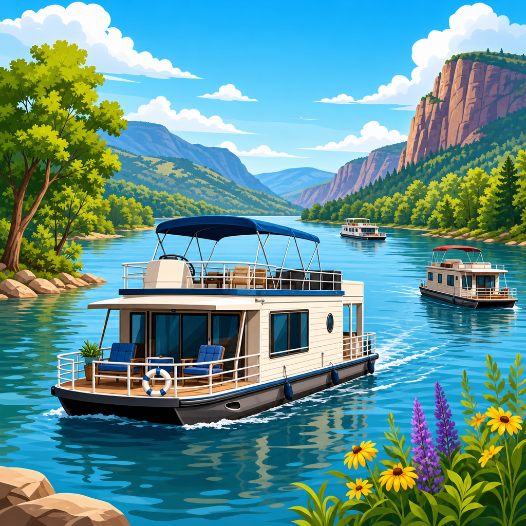
How to discover hidden coves and private beaches by boat starts with understanding what those places really are: small inlets, anchorages, pocket beaches, and lee-side landings that are often missed by road travelers and even by many boaters following the same crowded routes. In practical boating terms, a hidden cove is usually a naturally sheltered indentation protected from prevailing wind and swell, while a private-feeling beach may be publicly owned shoreline that is simply difficult to access except from the water. I have planned enough coastal passages and day trips to know that the best spots are rarely found by luck alone. They are identified through chart study, weather interpretation, local knowledge, and disciplined on-water observation. This matters because the difference between an unforgettable quiet anchorage and a dangerous dead-end inlet often comes down to preparation. For travelers building a list of hidden and underrated boating destinations, this hub covers the core process: how to research, evaluate, approach, enjoy, and protect secluded places that reward careful seamanship.
Hidden & underrated boating destinations attract experienced crews for good reason. They offer reduced wake traffic, clearer snorkeling conditions, quieter overnight anchorages, and a stronger sense of exploration than heavily promoted marinas or beach towns. They can also create logistical advantages. A cove tucked behind a headland may provide better holding and comfort than a popular harbor two miles away. A sand spit reachable only by skiff may become the highlight of a family charter because children can swim ashore without crowds. Yet these places carry risks: unmarked rocks, shifting bars, private property boundaries, marine protected area rules, and exposure changes as tides and afternoon winds build. Good destination planning therefore combines cruising guides, official charts, satellite imagery, depth data, and local regulations. This article serves as the main gateway for that planning, helping boaters identify candidate coastlines, compare destination types, and choose techniques that work whether they run a center console, trailerable cruiser, RIB, sailboat, or bareboat charter.
Start with charts, satellite imagery, and local knowledge
The most reliable way to find hidden coves and private beaches by boat is to layer information sources instead of relying on a single app. Begin with official hydrographic charts from NOAA in the United States, the UK Hydrographic Office in many international waters, or the relevant national authority for your region. Look for contour lines that tighten around points and then open into protected water, symbols for rocks awash, bottom composition notes such as sand or mud, and anchorage markings. Next, compare those charted features against satellite imagery in tools such as Navionics, C-MAP, Google Earth, or Aqua Map. Imagery often reveals beach pockets, reef color changes, creek mouths, mangrove cuts, and shoal patterns that charts generalize. I routinely drop waypoints on three kinds of prospects: coves with a narrow entrance and wide interior, beaches screened by bluffs or dunes, and islands with a calm lee side under the prevailing wind.
After digital research, add human intelligence. Harbormasters, launch ramp regulars, fishing captains, and local sailing schools usually know which coves stay calm in a sea breeze, which beaches become unusable at low tide, and which “secret” spots are now tightly regulated. Cruising guides from authors such as Nigel Calder and regional publishers remain useful because they explain why a place works, not just where it is. In the San Juan Islands, for example, chart work may point you toward a tiny indentation, but local advice will tell you whether current at the entrance makes dinghy access unsafe near max ebb. In the Exumas, satellite imagery can suggest dozens of beaches, yet local charter briefings clarify which cuts become rough with wind-against-tide. Hidden destinations are discovered fastest when you combine map interpretation with area-specific seamanship that only locals and well-written pilot books provide.
Know what makes a cove genuinely usable
Not every beautiful inlet is a good destination. A usable hidden cove needs safe approach depth, manageable swell, adequate swinging room or shoreline access, and legal permission for the activity you intend. The first question is protection. Study prevailing wind direction by season, not just by today’s forecast. On the U.S. East Coast in summer, a cove open to the south may look calm in the morning yet become sloppy after a thermal sea breeze develops. In the Mediterranean, a bay that feels secure under light northerlies may become untenable when a mistral event builds. The second question is bottom type. Sand and mud usually provide predictable holding; heavy weed, smooth rock, or steep shelving often do not. The third question is traffic. Some “hidden” beaches sit beside ferry routes or popular rafting areas and lose their appeal after midmorning.
A practical screening method helps boaters compare options before departure.
| Destination factor | What to check | Why it matters |
|---|---|---|
| Approach depth | Charted soundings, tide range, sonar track | Prevents grounding on bars, shelves, and shoals |
| Wind protection | Exposure by compass direction and local forecast | Determines comfort at anchor and beach landing safety |
| Bottom holding | Chart notes, guidebooks, recent boater reports | Affects anchor security and overnight suitability |
| Swell and wake | Headland screening, passing traffic, open fetch | Separates calm coves from rolly anchorages |
| Access ashore | Beach gradient, dinghy landing, rocks, surf | Decides whether the spot is practical for swimming or picnics |
| Rules and ownership | Marine parks, reserves, private land boundaries | Avoids trespass, fines, and habitat damage |
When a destination scores well across those categories, it is worth scouting. When one category fails badly, move on. That discipline saves time and avoids forcing a marginal anchorage to work.
Use weather, tide, and light to your advantage
Weather and tide separate confident cove hunters from boaters who merely wander coastlines. The best time to inspect hidden beaches is often with the sun high enough to read water color but before afternoon wind peaks. In clear tropical water, late morning light can expose coral heads and sand tongues that are invisible at low angles. In temperate estuaries, a rising tide may open access to back-beach creeks and shallow lagoons, while an ebb can leave a skiff stranded well offshore. I have found many worthwhile pockets by timing arrival one to two hours before high water, making a slow reconnaissance pass, then deciding whether to anchor outside and shuttle in by tender. That method is especially effective in places like Florida’s Gulf Coast, the Bahamas, or Croatia’s island coves where tidal or water-level changes interact with shoals and limestone shelves.
Forecast interpretation should be specific, not casual. Wind direction, period, and local topography matter more than generalized “good boating weather.” A hidden cove can be unusable if refracted swell wraps around a point, even on a fair day. Apps such as PredictWind, Windy, and the NOAA Marine Forecast are valuable, but they should be checked against local observations. If whitecaps are already visible outside a headland that supposedly protects your target bay, believe the water, not the screenshot. Also consider return conditions. Many secluded beaches feel easy to enter with wind behind you and far less easy to leave after lunch when chop stacks on the shoals. The most successful boaters build a simple weather gate: if forecast wind exceeds their landing or anchoring threshold, they shift to a secondary cove with better shelter.
Choose the right boat setup for secluded exploration
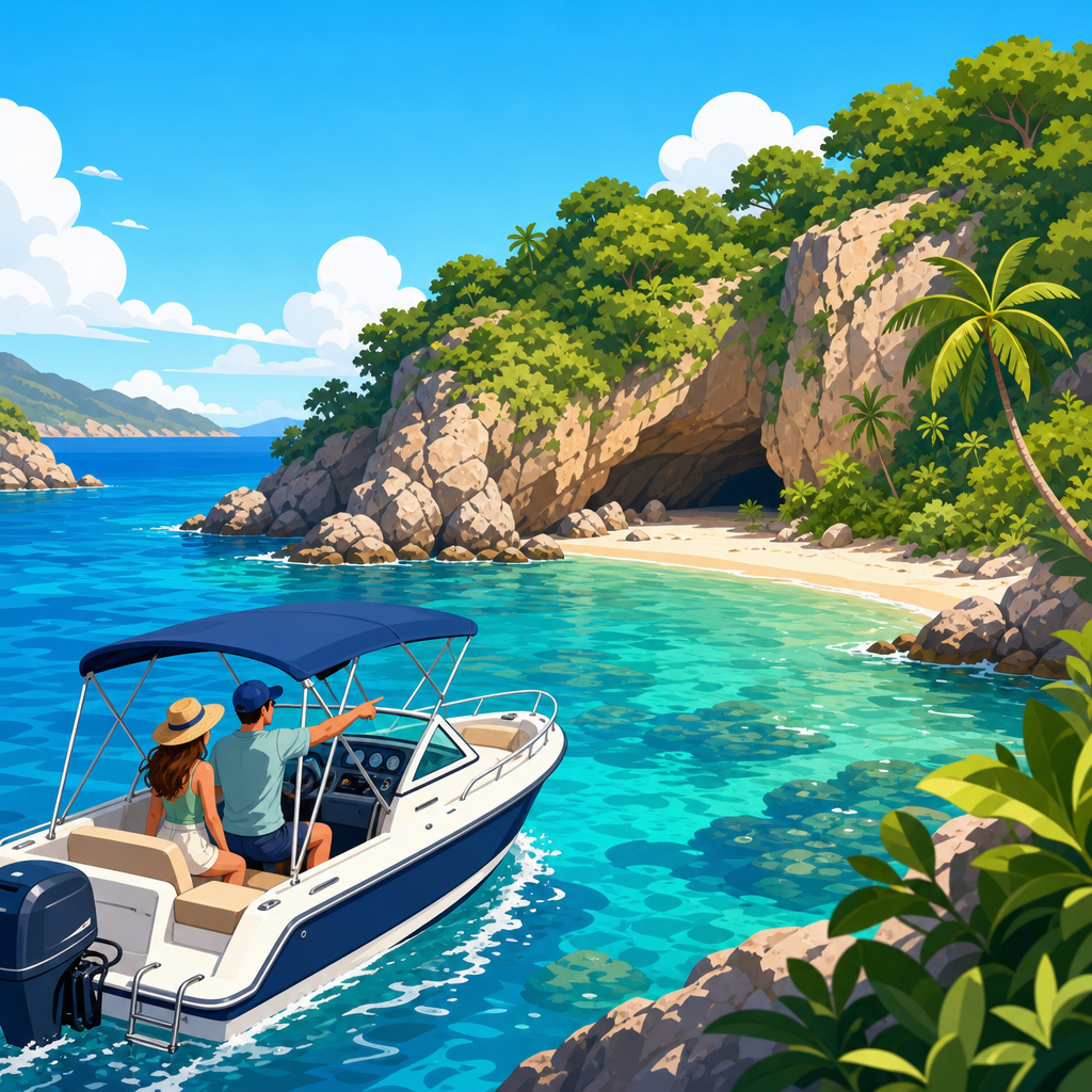
Different boats reveal different classes of hidden destinations. A center console with a shallow draft can nose into sand-fringed coves and support quick scouting runs, but it may offer limited overnight comfort if the anchorage becomes exposed. A cruising sailboat can reach remote island groups efficiently and anchor comfortably, yet keel depth restricts how close it can approach a beach. Trailerable pocket cruisers and rigid inflatable boats are often ideal for hidden and underrated boating destinations because they combine mobility with access. In my experience, the winning setup is less about size than about control at slow speed, anchor handling, and tender logistics. A reliable chartplotter, depth sounder, handheld VHF, and a properly sized primary anchor matter more than a long equipment list.
For beach access, a tender changes everything. Many outstanding spots are best treated as two-stage destinations: anchor in safe water, then go ashore by dinghy, paddleboard, or swim line. That reduces the temptation to force a larger vessel into skinny water. It also opens destinations in places such as Maine’s granite coves, British Columbia’s inlets, or the Balearics, where rocky shallows guard clean pocket beaches. Carrying a stern anchor, anchor alarm, polarized sunglasses, and a basic shore kit with water shoes, dry bags, and a trash sack makes these landings easier and cleaner. If your boat lacks a tender, focus on coves with forgiving sandy approaches, low surf, and enough depth to anchor within comfortable swimming distance. The boat should fit the destination type, not the other way around.
Find underrated boating destinations by region and pattern
Boaters searching for hidden and underrated boating destinations often look for exact coordinates, but patterns are more transferable than any single waypoint. On barrier coasts, the best private-feeling beaches are commonly found on the sound side or behind inlets, where ocean surf is blocked and road access is limited. On island chains, the lee side opposite the dominant wind frequently holds calm water and less boat traffic, especially if marinas and charter bases sit on the weather side. In fjord, ria, and estuary systems, side coves branching from a main channel often provide the quietest anchorages because through traffic stays in deeper fairways. Learning those patterns lets you discover new spots in unfamiliar cruising grounds quickly and safely.
Real-world examples show how this works. In the Florida Keys, many visitors crowd famous sandbars, yet smaller mangrove-fringed basins and channel-edge beaches offer better wildlife viewing and less wake if you approach on the right tide. Along the Dalmatian Coast of Croatia, headline islands draw flotillas, but dozens of lesser-known uvalas on outer islands provide clean water and secure lunch stops when bora and maestral conditions are understood. In New England, pocket coves on the backs of peninsulas can be far quieter than marquee harbors, though lobster gear and tidal current demand attention. In Greece, the Cyclades are wind exposed, but neighboring island groups and leeward micro-bays can deliver swimmable, peaceful anchorages if meltemi forecasts are respected. The takeaway is simple: destination discovery improves when you analyze coastline shape, access limitations, and wind exposure instead of chasing famous names.
Respect legality, privacy, and environmental limits
A private beach is not necessarily a beach where you may land freely. Shoreline law varies widely. In some jurisdictions, the wet-sand area below the high-tide line remains public; in others, landing may still be restricted by conservation rules, resort leases, tribal authority, military boundaries, or marine park management plans. Responsible boaters verify status before stepping ashore. National park and marine protected area maps, harbor ordinances, and local notices to mariners should be part of trip planning. I have changed plans more than once after discovering that an inviting beach sat within a bird nesting closure or no-landing reserve. That is not a disappointment; it is evidence that the system is working to preserve the destination.
Environmental discipline also protects the very solitude you are seeking. Use established moorings where required, avoid anchoring on seagrass meadows such as Posidonia in the Mediterranean or turtle grass in the Caribbean, and keep wakes low near shorebird habitat, kayakers, and swimmers. Pack out everything, including food scraps and fishing line. Keep music low because sound carries across water and quickly destroys the sense of remoteness for everyone nearby. If you share location details online, be selective. Broadcasting fragile coves with exact access notes can overload places that have no facilities and little resilience. The best boaters treat hidden beaches as borrowed privileges. That mindset preserves them for future trips and strengthens local support for boating access.
Build a repeatable trip-planning system
The smartest way to keep finding hidden coves and private beaches by boat is to create a repeatable planning workflow. Start a destination log with columns for chart source, exposure, draft limits, best tide stage, bottom type, landing notes, nearby hazards, and legal status. Save screenshots of satellite imagery with your intended route and alternate anchorage marked. On the water, record actual depths, anchor set performance, and how conditions changed through the day. After several trips, patterns emerge. You will know, for example, that your boat can comfortably anchor in eight feet over sand with a specific scope ratio, that a certain local sea breeze usually arrives by 1400, or that north-facing coves in your area remain clear after a frontal passage. Those personal observations become more valuable than generic lists.
This hub article is the foundation for exploring the full world of hidden and underrated boating destinations. From here, the next logical steps are regional guides, anchoring techniques, dinghy landing tactics, seasonal weather planning, and conservation-focused cruising advice. The core lesson is consistent across every coastline: the best secluded places are discovered through methodical research, cautious approach, respect for rules, and willingness to turn back when conditions do not match the plan. That approach leads to quieter anchorages, better beach days, and safer boating. Start with one coastline you know, mark three overlooked candidates, verify the forecast and regulations, and scout them carefully on your next outing. Your best boating destinations are usually closer, and less obvious, than you think.
Frequently Asked Questions
What counts as a hidden cove or private beach when you are exploring by boat?
In boating terms, a hidden cove is usually a small inlet, indentation, or natural anchorage that offers some shelter from prevailing wind, swell, or boat traffic. These spots are often easy to miss from land and sometimes even from the water if you are only following the most common cruising routes. A private-feeling beach does not always mean legally private property. Very often, it refers to a shoreline that feels secluded because access by road or trail is difficult, parking is limited, or the beach is tucked behind headlands, reefs, bluffs, or shallow approaches that keep crowds away.
That distinction matters because boaters should separate the feeling of seclusion from actual ownership and access rights. Some beaches are truly private and tied to adjacent landowners, while others are public below the high-tide line or fully public despite having little practical access from shore. Hidden coves can also include pocket beaches, lee-side landings, quiet anchorages behind islands, or narrow cuts with calmer water on one side of an exposed coastline. Understanding these categories helps you plan more intelligently, because the best destination may not be the prettiest one on a map, but the one with the right depth, protection, holding ground, and legal access for the conditions that day.
How can I find hidden coves and secluded beaches safely instead of just guessing?
The safest approach is to combine chart work, local knowledge, and real-time observation. Start with marine charts, cruising guides, satellite imagery, and navigation apps that show shoreline contours, depth changes, bottom composition, and hazards such as rocks, reefs, kelp beds, sandbars, and shoals. Look for small indentations on the lee side of islands or points, especially areas protected from the day’s prevailing wind and swell direction. A cove that looks ideal on a map may be completely exposed in certain weather patterns, so always match your destination to the current forecast rather than to a photo or recommendation alone.
Local information is equally important. Marina staff, harbor masters, charter operators, fishing captains, and experienced local boaters often know which coves remain calm in afternoon winds, which beaches have tricky surf landings, and which anchorages become uncomfortable with tide swings. Once you approach a potential destination, slow down and read the water carefully. Watch for breaking waves over submerged rocks, color changes that suggest shallow areas, current lines, and how other anchored boats are lying. If you are entering a narrow or unfamiliar cove, make a cautious reconnaissance pass first rather than rushing in. In many cases, the safest decision is to abandon a marginal spot and move to a more open but reliable anchorage nearby. Hidden places are only worth finding if you can enter, anchor, and depart them safely.
What equipment and preparation do I need before boating to remote coves or hard-to-reach beaches?
Preparation should focus on navigation, anchoring, weather awareness, and self-sufficiency. At a minimum, you want updated charts, a dependable GPS or chartplotter, a compass, a charged phone in a waterproof case, and ideally a VHF radio for communication. Because hidden coves often involve tighter spaces and less room for error, your anchor setup matters a great deal. Carry an anchor suited to your boat and bottom type, enough rode for changing depths, and a clear understanding of scope. A boat hook, stern line, fenders, and a means of securing a beach landing or dinghy transfer can also make a major difference when visiting small inlets or pocket beaches.
You should also prepare for the fact that these spots may have no facilities, no cellular coverage, and little immediate assistance nearby. That means bringing drinking water, sun protection, basic first-aid supplies, spare lines, navigation lights if there is any chance of a late return, and enough fuel reserve to reroute if conditions change. Study the tide tables before you go, especially if your destination includes a shallow approach, exposed sand at low water, or a beach landing. It is also wise to share a float plan with someone on shore, including where you expect to go and when you plan to return. The more remote and secluded the destination, the more important it is to be capable of solving small problems without outside help.
How do I know whether I am allowed to land on or use a secluded beach?
Access rights vary widely by country, state, and even local municipality, so there is no single rule that applies everywhere. In some places, the beach below the mean high-tide line is public, while the upland area behind it is private. In other regions, adjacent property ownership can affect how and where you may land, walk, anchor, or pull a dinghy ashore. Protected areas may also have separate rules covering wildlife habitat, seasonal closures, no-landing zones, anchoring restrictions, marine preserves, or limits on fires, dogs, fishing, and overnight stays. That is why checking local regulations before you go is just as important as checking the weather.
A good practice is to verify access through official sources such as harbor authorities, park agencies, coastal management departments, or marine protected area maps. Signage on shore should be respected, but remember that signs are not always easy to see from the water, so research ahead of time is essential. If a beach appears attached to homes, docks, or estate frontage, do not assume you can cross into dry sand, use stairs, or move beyond the public intertidal zone. Even where access is legal, courteous behavior matters. Keep noise low, avoid blocking private docks or moorings, stay clear of nesting areas, and leave no trash behind. The goal is not just to avoid fines or conflict, but to preserve access and goodwill for everyone who enjoys exploring secluded shorelines by boat.
What is the best way to anchor near a hidden cove or beach without damaging the area or putting my boat at risk?
The best anchoring strategy starts with choosing the right spot, not just dropping the anchor in the prettiest water. Look for adequate depth at all tide stages, enough swinging room for your boat, and bottom types with good holding, such as sand or mud where appropriate. Avoid anchoring over coral, seagrass, or sensitive habitat whenever possible, both to protect the environment and because these areas often provide poorer holding than boaters expect. In a small cove, pay close attention to how wind and current may shift over several hours. A location that feels secure on arrival can become uncomfortable or dangerous when the breeze wraps around a headland or the tide reverses.
When setting the anchor, lower it with control, pay out proper scope, and back down gently to confirm it is holding. Use visual references and electronics to monitor whether your boat is dragging, especially in tight anchorages. In some secluded coves, boaters use a bow anchor with a stern line to shore to control swing, but that technique requires care, local knowledge, and respect for shoreline regulations and other users. If you plan to go ashore, think through how surf, wake, and tide changes will affect your return to the boat. Most importantly, never let the appeal of isolation push you into a marginal anchorage. If there is poor holding, surge, limited room, or uncertain weather, move on. A truly successful hidden cove is one that feels calm, secure, and sustainable from arrival to departure.